(Almost) Same Time; (Almost) Same Place; Different World (Almost) Every Time

Guest blog by Iain, who’s been enjoying the wonderful winter conditions in the mountains …

It always surprises me when people aren’t perhaps a little shame-faced about refusing to climb the same hill multiple times.  Seems a pretty clear indication that it was only climbed in the first place to allow it to be ticked off a list.  After all, like crossing a river, it is nigh-on impossible to climb the same hill twice and have the same experience.  Sometimes the experience is so different to the previous visit as to bear no comparison.

DSCN1314
Cairn Toul, Braeriach and Ben Macdui viewed from Carn an t-Sagairt Mor

This year has been a good example of what I mean.  OK, I will admit that the January 1st ascent of Mount Keen is perhaps not one I will remember as having been more than a pleasant day out.  But from then onwards it has been an excellent year full of new experiences, in spite of it involving the same hills I always do at this sort of time of year – and all of them in pretty good weather.  A snowshoe-supported round of the Loch Callater hills was noteworthy for the lack of seeing anyone “on foot” – not even any footprints.  The only other person able to get up there was on skis.  As part of the quest for new experiences I thought I would settle down at the summit of Cairn of Claise and wait for the sunset to develop….wearing two pairs of gloves and a pair of mittens, a headband, a hat, a thick winter jacket, a thick primaloft jacket and a thin down jacket….all with the hoods up.  The sunset was indeed stunning, but I had to head off before it reached its zenith as I was shivering so badly I could no longer operate the camera. DSCN1356 However, the thing that struck me most was the discovery that a mere two or so miles away and only a few hours earlier, a friend was climbing An Socach, just in a base layer and only needing gloves and a jacket on nearing the summit.  Different world indeed.  Even the wearing-on of the afternoon makes the mountain change in ways you might not really expect – I love the way the feel of the snow changes as it hardens up just from a small drop in temperature….though I am not so fond of when it instead softens up after a day of sunshine and, instead of skittering lightly over the surface, you sink in over your knees.


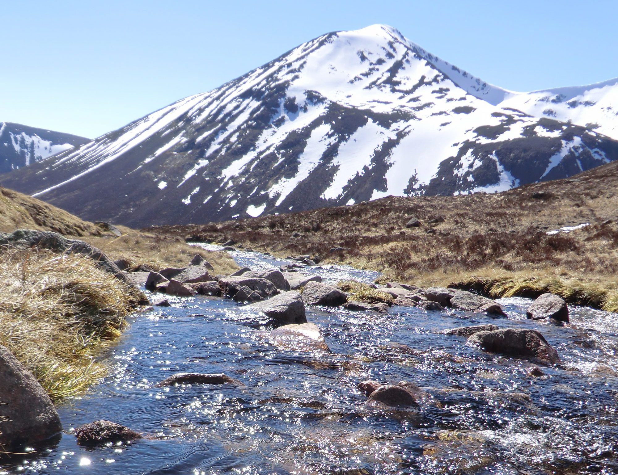
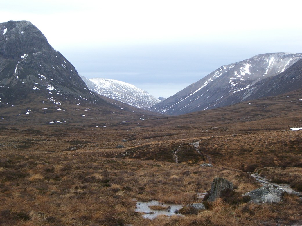
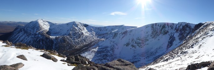
Heading back to the same area two weeks later really underlined the way the snow changes, with a round of the Loch Muick hills, starting with Lochnagar.  The ascent Lochnagar from the Loch Muick carpark can indeed feel a bit repetitive (even more so for those laden down with a mass of climbing gear) but even it has been different every time – last year I entered the cloud as soon as I reached the cliffs and only suddenly exited when I moved two metres north of the summit – yes visibility was pretty much zero on the summit but a mere two metres down from it was enough to get into a stunningly sunny day.  This year, all that lovely thick snow had suddenly turned to rock-hard ice.  I lazily put on snowshoes to go up the boulder field, rather than crampons, simply because they were easier to reach.  Thus, I not only looked totally ridiculous clambering up the crowded summit in them, but later suddenly found myself inadvertently skiing down the eastern side of White Mounth, as they completely failed to grip the ice.  Clutzy yes; dangerous, not really. The middle two hills, Carn an-t Sagairt Mor and Cairn Bannoch were just as empty of people as when I had been on them the previous week, but had a completely different feel about them, when covered in ice rather than snow.  The major difference though was that, for no obvious reason, I was absolutely shattered (and will admit that I later had to resort to listening to an audiobook to keep my mind off how curiously tired I felt).  The other difference was how much more light there was.  I had been aiming merely to get back to the pony hut (where the track starts at the bottom of the final climb up Broad Cairn) before it was completely dark.  Instead I was back down at the Loch.  What a difference even just two weeks makes to the length of the day!

Photo0012

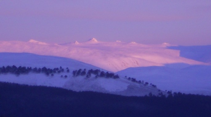
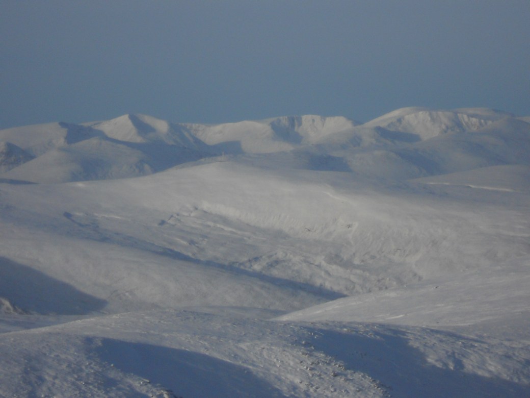
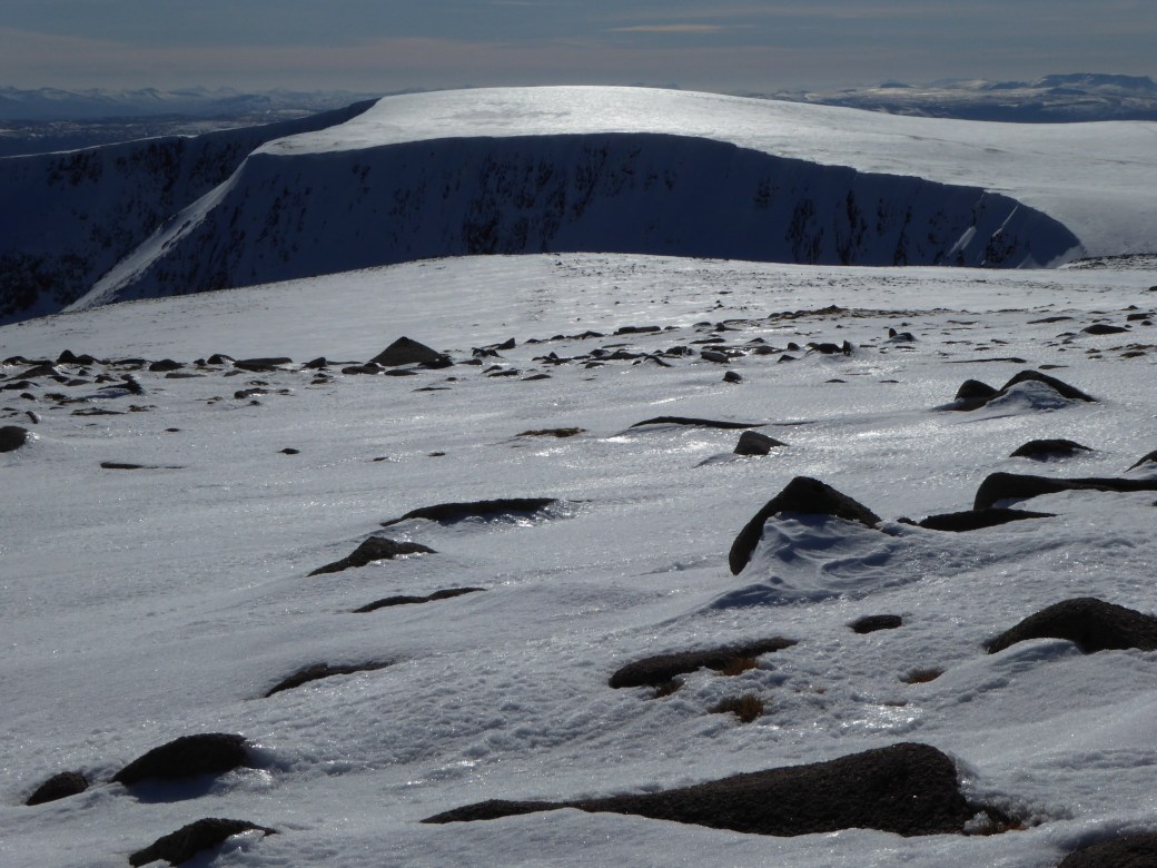
Last weekend, with a rather dismal forecast, I headed up Culardoch and Carn Liath, two easily-accessed Corbetts at the eastern end of the Cairngorms – now surely this would be a generic day out: I would trudge through the forest and up the track, maybe getting the odd view through the mist, maybe finding a light coating of snow, but otherwise it would be unmemorable and probably nothing more than a bit of exercise and an excuse for a lot of junk food.  Well, that is roughly how it seemed until about 600 metres, albeit with a considerable layer of snow on the track, when suddenly I popped out of the cloud and into a blue and white wonderland, with breath-taking views across the layer of cloud to Lochnagar. Photo0005
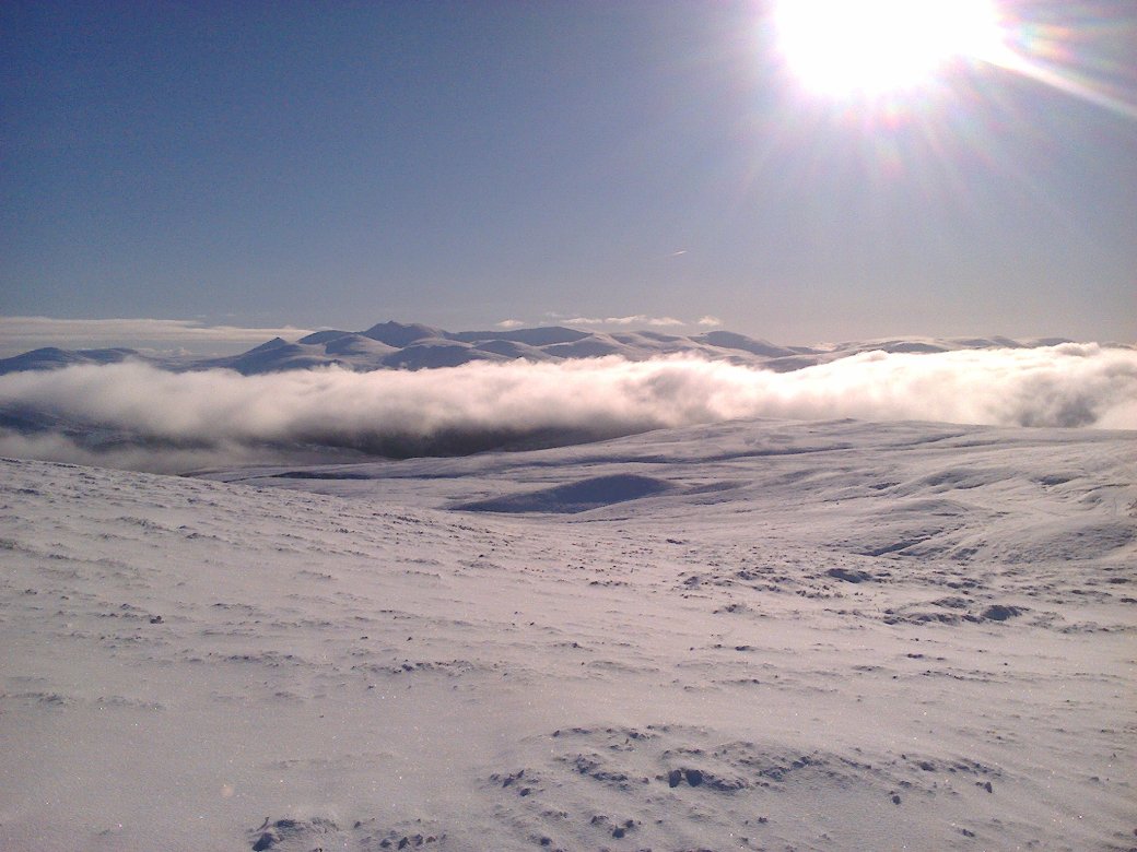
Even with snowshoes on, the ascent of Culardoch was hard work. Sitting on top of Carn Liath watching the sunset just in a light softshell, noting that there was absolutely no breeze or sound, I could see through to Cairn of Claise and was reminded of how perishingly-cold it had been there just a few weeks previously.

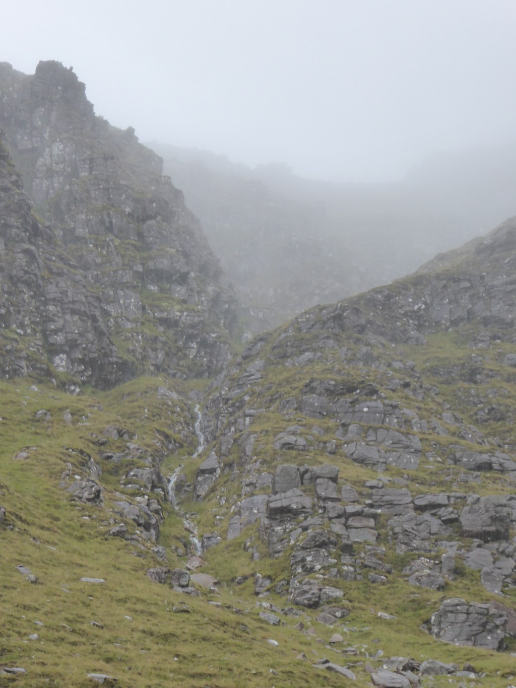
 OK, let’s not get too carried away: there are some days out that do feel pretty generic and non-descript, and disappear from memory rather quickly.  There are of course those that you remember because of how truly awful they were (Jasmin will remember all too well my “just follow the effing fence posts!” outburst in Glen Lyon – there are so many hours of torrential rain-meets painstaking micro-navigation before some tempers fray and you just want to get down by the quickest and easiest method).  I can even remember days because of how crushingly boring they were – an ascent in the Mamores with zero visibility and zero breeze was like being in a sensory deprivation chamber all day.  Amongst the strongest memories, as they are perhaps the ones in which the biggest shift in how you were feeling occurred, are those in which you suddenly pop out above the clouds.  A few years ago we did Glas Tulaichean on a day so dismal I would genuinely rather have been shopping or flicking through the channels on the TV….it simply sucked the life out of you.  Cold and spitting rain, poor visibility, a path covered in yucky slushy snow and streams in spate.  What on earth was the point in being out – especially as everyone else had decided not to bother?  Well, about 50 metres short of the summit, we popped out of the cloud.  Everywhere else in Scotland, as far as we could see, was under the cloud and no other hills were visible. 

OK, so that was the definitive ascent of Glas Tulaichean and every other visit would be kinda underwhelming? ….well actually the next year we approached it up the Cateran Trail via the intriguing Beinn Earb (always noted on the map, as it really stands out but….it isn’t on any list so why bother?).  This gave a superb springy high-level walk, always around the 700 – 800 metre level.  At this sort of level, one would normal anticipate a dispiriting bog! Instead it was a splendidly unexpected find. Even better was the sight of a line of over 100 deer all gracefully jumping (or very much less gracefully tripping over for some) the same high fence right in front of us. OK, so maybe Glas Tulaichean itself wasn’t exactly memorable once we, many, many hours later, finally got to the summit.

 So, in the same way as there is bad weather (not just bad clothing – 100 mph winds = bad weather!!!) there are doubtless also boring hills (and not just boring people) and really boring days out – but there are far fewer unmemorable days out than you might expect, even if you do the same hills over and over again each year.slide6

A Dusting Of Snow

P1020760P1020764Temperatures across the North East of Scotland have certainly plummeted this week, but it was already fairly cold last weekend when we headed over to Blair Atholl to climb Carn a’Chlamain. The previous few days had been wet, so the idea of a long walk-in on a dryish track had its appeal. The mountain forecast was not overly encouraging, but the day turned out fine: it was far less windy than suggested and as luck would have it we had picked an area that managed to remain in sunshine for most of the day. P1020772At higher levels there was a fairy-tale dusting of snow, while further up the wind had scoured the slopes, leaving exposed icy patches. The photos from the summit show a fair covering – a taste of things to come. A perfect winter mountain day with stunning visibility, a colourful sunset and a walk-out by the light of head torches.

P1020775
Carn a’Chlamain (963m)


[Thanks to Pauline, Joan and Iain, who all feature in these photos.]

slide8

Parallel Journey

I love black and white images. At times they can be much more thought provoking, creating an altogether different impression to a colour photo of the same scene. With this in mind, I set off on a mountain day last weekend with the idea of photographing various vistas in both colour and B&W.

P1020584P1020583

Loch Muick with Broad Cairn (behind): The B&W photo is altogether much more stark, and the contrast between the dark foreground and backlit background much stronger than its colour counterpart. However, the autumnal colours are what make the colour snap work here. Difficult to choose….P1020588
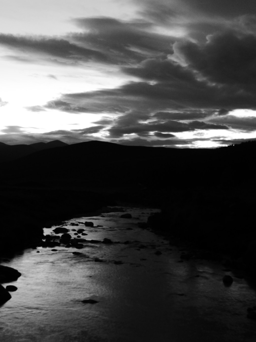
Loch Muick with Lochnagar in background (B&W): This image was taken along the Capel Mounth route from Loch Muick (pictured) to Glen Clova. The bleached grass in the foreground, together with the rock to the left, while presenting a foil for Loch Muick and Lochnagar behind, are actually dominating the photo.

P1020587Loch Muick with Lochnagar in background (colour):There is still a high level of contrast between the blonde grass and the background, but in this case the colours of the Loch and hillside create a more balanced impression. There is more ‘awareness’ of the background.

P1020606

P1020605

Track and Upland Burn: I find the colour image here much softer than the harsh shades in the B&W version. The autumnal hues add to this impression, which would probably be very different in, say, deep winter or early spring. But the B&W photo conveys a sense of loneliness and a sense of being in a very isolated place by its very lack of colour.

P1020610P1020609

Winding Road: I love both images here: the ribbon of the Capel Mounth draws the eye into the photo. Definition of the hillocks around the track is perhaps more of a feature in the B&W, whereas the colour version conveys a more dreamy impression due to the softer tones. P1020615
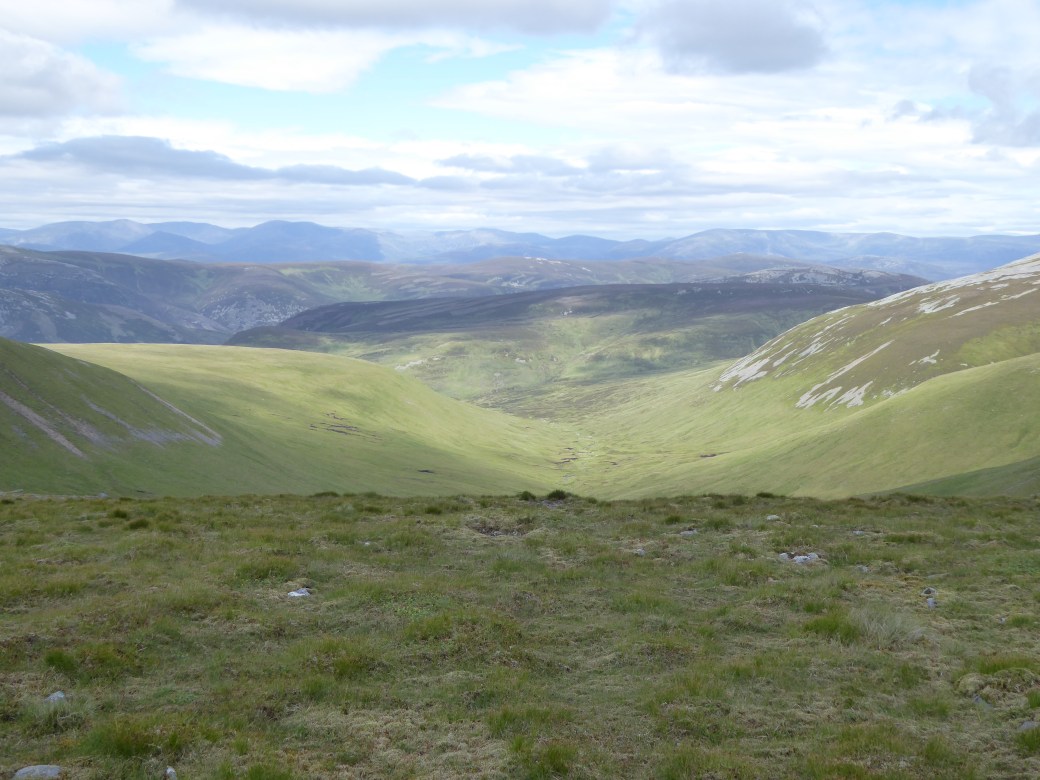
Looking towards Glen Clova (B&W): The inward facing slopes of these hills draw the eye towards the distant forest at a lower level. The upland area behind remains firmly in the background due to the washed out shading. P1020616
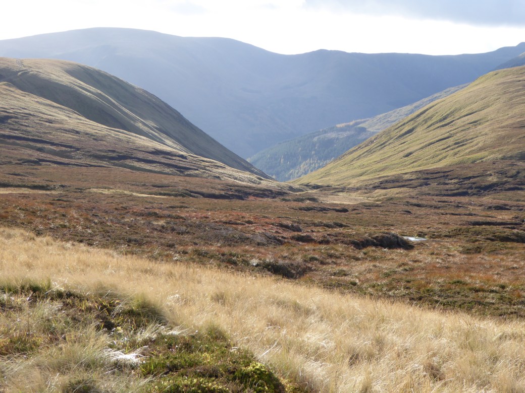
Looking towards Glen Clova (colour): The background comes across as even more remote here. The shape of the middleground hills do not make as much of an impact as in the B&W photo. The colours are almost a distraction, drawing the attention away from the bones of the landscape.

P1020619P1020618Looking down into Glen Clova: the quality of the light has given both images a soft focus character. To me, much B&W mountain photography seems to work best with high levels of definition and contrast therefore the colour photo is more successful here. The greens and yellows add further to the softness of the picture. Of course, I may well change my mind about this with different light conditions – or at a different time of year.

I reached the summit of Broad Cairn by the time the sun was going down and the final couple of hours back to the car were done in semi-darkness. The Full Moon rose over Mt Keen, initially a brilliant orange, fading to yellow and finally becoming silver as it sailed higher into the night sky. The wind up high was biting and as I walked back the temperature at glen level was plummeting. The mountain hares have turned white and winter is on its way ….

P1020672P1020682slide5

Summer Into Autumn In Pictures

JULY:

P1010895
The approach to Beinn Mheadhonach (from Old Blair: Beinn Mheadhonach (901m) & Beinn Dearg (1084m): 28km, approx. 1100m ascent)
P1010891
Intriguing gate in fence …

P1010906

P1010921
Views to the distant Cairngorms

P1010954

AUGUST:

P1020059
A Cairngorms day: Derry Lodge (start) – Beinn Mheadhoin (1182m) – our objective is in the distance.
P1020070
The Hutchinson Memorial Hut
P1020079
Weather deteriorating on Beinn Mheadhoin

P1020100

P1020103
Iain looking enthused on the very long walk out…
P1020111
Torridon, NW Highlands. Ascending Beinn Alligin (986m). A very, very wet day with little respite. 
P1020113
Pauline, Judith, Mary at the first summit: no views.
P1020128
The following day we headed back east to the Cairngorms – much drier – and we got views!

P1020126

SEPTEMBER:

P1020192P1020196


P1020201
Bennachie and its butterflies (above)
P1020299
Glas Allt Shiel Lodge with the Lochnagar massif behind
P1020289
Loch Muick
P1020300
The autumnal colours of deer grass, Broad Cairn (998m) behind


P1020291

P1020320
Loch Muick in brooding weather


Moonshadows And The Devil

‘Valiant and quite possibly insane (blame the full moon) overnight outing to Devil’s Point, located in the midst of the Cairngorms. Approx. 32 km, 11 hrs and 58 mins (including some hefty breaks), over a mixture of terrains, some of them kinder to us than others. Started at 10.30 p.m. and gained the summit of Devil’s Point at 4.05 in the morning in miserable conditions, then long walk out via White Bridge.’

P1010863

Sometimes I have an idea. Sometimes that idea (fortunately) remains nothing more than an idea, but at other times something drives me forward to put that particular scheme into practice and make it a reality. Unfortunate or not, it’s usually the more way-out inspirations that are the ones that come to life….

When I contacted Cameron on the spur of the moment with the idea of doing a hill day at night I figured that more than likely he would be busy with far more important and normal things, but the response was pretty immediate – after all, who would want to turn down such a crazy idea as a night hike into the middle of the Cairngorms? And this was not to be just a mere wild camping or bivvying trip – oh no – this was far less sensible. This would mean starting late in the evening and walking through the night and on into the following morning. Even on my Mountain Leader training and assessment, night navigation had taken up only a part of the night. And any alpine starts for high altitude peaks had usually been early morning, again not through the entire night. The closest I had come to running a mountain ‘day’ on the back of a ‘normal’ day was when Iain and I made what was, to us at any rate, a fairly epic ascent of Mount Rainier (Washington State, US, 36 hours on the mountain – 45 hrs more or less without sleep – but that’s another story altogether) – but even for this we did have a few hours of rest. With that particular adventure under my belt, I knew that what I was planning now was feasible.

2011_1229OctNov20080006
The sinister black cliffs of Devil’s Point can be seen on the left of this winter photo. It guards the entrance to the lower reaches of the Lairig Ghru like a sentinel.

Devil’s Point gets its name from a rather sanitised translation of the Scots Gaelic Bod an Deamhain. The story goes that John Brown, Queen Victoria’s ghillie, in accordance with the straight-laced sensibilities of the day, provided her with a somewhat more bland translation than the rather earthy ‘Penis of the Devil’. The mountain is technically a subsidiary peak of Cairn Toul (third highest Munro), which rises some 287m above it to the north west. However, Devil’s Point is classed as a Munro – and it’s a hill that, since he heard of it, Cameron has always wanted to bag. It has a glowering, brooding and sometimes almost sinister presence, particularly evident when approached from the south. Its sheer black cliffs are distinctive and what it lacks in height (a mere 1004m, which is nothing in Cairngorm terms), it certainly makes up for in character.

And so it was that we arrived at the Linn of Dee car park at 10 p.m. Cameron was highly organised and was ready to go within a matter of minutes, while I took slightly longer, having to switch my mind to mountaineering from horse riding mode. Rather than sticking with just the one insane plan, I had opted to go for a reasonably long hack directly before coming out to the mountains, so riding paraphernalia was jostling with mountain kit to lay claim to space in my car boot. Eventually, after I had located the necessary items, we were ready and set off around 10.30 p.m. P1010826

P1010818

This part of Scotland is so far north that at the height of summer the sun sets just after 10 p.m. and, on a clear night, it never really gets dark at all – sunrise is usually not long after 4 a.m. We had more than reasonable light as we left the car park. Numerous stops were made in attempts to capture the amazing evening light on camera, but we were making very good progress on the track out to Derry Lodge. At one point, just after I’d mentioned that the full moon would have risen in the south east, the stratus layers started to fragment and suddenly there was the moon, sailing in and out of the clouds. As the remaining evening light dimmed, there was absolute amazement to see our shadows cast to the side of the track so clearly: moonshadows. It’s easy to forget just how much light the moon does actually cast upon the landscape when living in a built up area, where the moon doesn’t stand a chance against street lighting. There’s something magical and mad about moonlight: a half light, a glow that can be deceptive: all is not what it seems in the light of the moon. To the north west there was a red glow in the sky, while to the west, the sky was ‘quiet’: not completely dark, a strange not-even-half light was ahead of us. We passed Derry Lodge, quietly made our way across the bridge and continued along the path towards the Lairig Ghru.P1010843

Our first break was by the Luibeg Burn. Doing a full mountain ‘day’ at night, when that night is a continuation of a day (where more than twelve hours have already been spent active), proves more of a challenge because you are working against the natural rhythms of your bodyclock. At 12.30am the body isn’t accustomed to taking on board food or vast quantities of water. Despite eating being reduced to a mere mechanical process, it was still necessary to take on some food and liquid.  Our first break over, we continued on our way, on, on and on. The moon floated in and out of the clouds, but was eventually overwhelmed while ahead of us, in the strange dim light of a Scottish summer night, we could see the cloud base resting on Beinn Bhrotain.

P1010852
Crossing the Luibeg Burn

It was a strange feeling to think that we may well have been the only people on the move through the mountains that night. The path took us around the bottom of Carn a’Mhaim and turned northwards while (depressingly) starting to lose height, dropping towards the youthful River Dee. Across the river, past Corrour Bothy (with numerous tents pitched outside – the Bothy was probably overflowing as it was a local holiday weekend) and as we started to climb, the weather started to come in. There were spits and spots of rain initially, then the wind started to really pick up and the cloud base dropped. We were on the final approach to the rim of the Corrie Odhar before we stopped again. Substantial wisps of cloud were pelting over the top of the corrie and it seemed like a very good idea to don any extra layers before putting our heads above the parapet. It was definitely lighting up by this time, but sadly it didn’t look as though we were going to see the sunrise from the summit of Devil’s Point.

P1010855
The view at the summit of Devil’s Point

Once over the lip of the Corrie, the wind was not nearly as bad as just below (very often this is the case). We had poor visibility, but there was a path of sorts. We followed this, but checking the compass bearing frequently (as paths cannot always be trusted to take you to where you actually want to go!). After more climbing, it became apparent that we were handrailing the cliffs to the south side of the mountain, and pretty soon we could make out the summit cairn/shelter. 4.05am.P1010858

A lengthy break ensued. There was the vain hope that the skies would clear and we would get views, but the weather began to worsen. Cameron was introduced to the usefulness of a group shelter, effectively a huge lightweight bag which climbers can sit inside to provide some protection from the elements. With people inside, the environment soon warms up, and if you insulate yourself even further by sitting on your rucksack (or sit mat), it can turn a miserable break into a semi-luxurious rest. After sensible food – and then the obligatory chocolate bar – with the sound of rain battering against the shelter and that very natural 4-in-the-morning tiredness catching up on us, it was all too tempting just to stay sitting there.  But no, we still had a very long way to go.

P1010860
Propping up the group shelter…

We dropped down from the summit to the col, where the visibility was just slightly better, briefly considered going on to Cairn Toul before deciding that the sensible plan was to head down. Down, down through Corrie Odhar, with frequent stops to shed the many layers that had been required on the summit. Conversation revolved around the Devil: all those sayings – ‘The Devil in us’; ‘Devil take the hindmost’; ‘Devil’s advocate’; ‘Needs must when the Devil drives’; ‘The Devil makes work for idle hands’; ‘The Devil is in the detail.’ The idea that the Devil is something inside all of us that needs to be confronted and dealt with….yeah, well just see what erudite discussions you can come up with at that time of morning! We silently walked past the tents outside Corrour Bothy feeling extremely smug that we’d been doing our mountain day at night, while all these hill-goers had chosen the soft option to sleep.

P1010870
Devil’s Point

Now it was a case of walking out. The cloud base remained at a consistent level, around the 800m mark, and until the very last, Devil’s Point refused to reveal itself. We followed the east side of the Dee on a path that involved quite a lot of mud (although I have walked this route when it’s been far worse…), energy, distance and time. Eventually we reached White Bridge (and no, it’s not white) for the final plod back to the car park along a good track. We enviously eyed up the bicycles that were being used by walkers coming in the opposite direction. One guy cheerily called out ‘Good Morning.’ We looked at each other in amazement. What did he mean – ‘morning’? Our morning had started some 9 and a half hours earlier and as far as we were concerned it was already well and truly over.

And so it was that we arrived back at our starting point. The one thing that wasn’t any different to any other hill day, was that relieved thought of ‘Oh good, the car’s still there’. But the experience was an unforgettable challenge that will remain in the memory banks forever.slide6P1010881

The Tale Of Mary And Tom Buidhe

Tom Buidhe:

Elusive … Tricksy … Shy … Retiring … Overshadowed … Part of the background … Unassuming … At one with the landscape … Unremarkable … Difficult to find … Lonely …

At 957m above sea level, Tom Buidhe is located in the midst of a rolling high moorland-plateau. It’s well set back from the Glen Shee hills of Cairn O’Claise and Carn an Tuirc. It’s just far enough off the Lochnagar circuit for most people to leave it out, while using Jock’s Road from either side (from Loch Callater or from Glen Doll) means a long walk in. Even on a clear day, it’s difficult to make out Tom Buidhe as it blends in so well with its surroundings – a rounded hummock with seemingly few defining features. It’s a navigational challenge in poor conditions: when the cloud base is down, or when there’s snow on the ground, careful use of the map and compass are required, together with techniques pacing and timing and a good understanding what the contour lines are telling you. On any hill, on any occasion, time, conditions underfoot or weather, or a combination of all three factors can conspire against the hill-goer.P1010789

There now follows The Tale Of Mary And Tom Buidhe:

Once upon a time there was a mountaineer called Mary. Mary was working her way through her Munros, was doing really well, but kept coming up against the problem of Tom Buidhe. It wasn’t that Tom Buidhe was a technically challenging hill in the same sense that the Black Cuillin Munros are. It wasn’t even that Tom Buidhe was deliberately being difficult, but time after time, Mary’s attempts to stand on the summit of this hill were thwarted. DSCF1367The first attempt was made from Auchallater one April under snow conditions. However, time constraints prompted a descent to Glen Callater from the summit of Tolmount, rather than proceeding from there on to Tom Buidhe. A second attempt was made from Glen Shee, but due to navigational error the expedition ended up on neighbouring Tolmount. With limited daylight, the sensible decision to turn around was made – after all, Tom Buidhe wasn’t going anywhere – it would still be there for the next time….  Now the number three is highly significant in fairy tales (it features heavily in Goldilocks and the Three Bears, for example), so by this token, Mary should have bagged Tom Buidhe on the third attempt. This time, however, conditions were extremely challenging. Heavy snow made the going  underfoot difficult, the wind was ferocious and visibility atrociously poor. A variant on the second route was chosen (coming up between Carn an Tuirc and Cairn O’Claise), but in the end the weather prevailed and Mary’s party beat a rapid retreat.

However frustrating this was, the key to staying safe is always to respect the mountain. Foolhardiness – that heady combination of proceeding regardless in extremely poor conditions coupled with summit fever- has often led hill-goers into trouble and in some cases to their death.  The UK mountains are sometimes regarded with derision as they lack the altitude of many international ranges, but due to the wide and often very rapidly changing weather conditions and also the nature of the terrain they can be every bit as challenging to the unprepared – and also to the prepared. The bottom line (without scaremongering) is that people can die out in the UK hills. Without a shadow of doubt, Mary made the correct call each time …P1010795

And so, this weekend just gone, a large party set off from the Glen Shee ski car park. Visibility was set to be good until early afternoon, when a rain bearing front was expected to move in. Mary’s fourth bid for the summit of Tom Buidhe was on the way! Over Glas Maol, then to Cairn O’ Claise. Careful identification of our objective had already been made from Glas Maol, from where Tom Buidhe appears as but a small rise dwarfed by the surrounding landscape rather than a distinct hill – it’s only when you’re on the final approach that it finally assumes a presence.  The wind was picking up and the weather changing as we finally approached the summit of the elusive Tom Buidhe. And yes, Mary bagged her summit this time, with time to admire the vista and take in its rather unique position in relation to all the hills that surround it.

P1010798
Mary at the summit of  the elusive Tom Buidhe


And the moral of the story? The mountain will always be there for another day.

[Note: Many thanks for a fantastic day to Mary, Pauline, Elaine, Iain, Angela, James, Claudia and Danny – and canine companions Heidi, Olive and Fergus]

slide5


Out And About

P1010541Mountain days needn’t all be mega-taxing experiences. That epic twelve hour plus day, moving at the speed of light, with very few stops can be an extremely satisfying physical and mental challenge, but it often doesn’t permit the luxury of really engaging with the surroundings. The past few weeks have been about shorter hill days, enjoying the scenery, and really absorbing the beauty of the changing seasons. Observing the change of colour to the hills, as the brown washed out appearance as a legacy from the Autumn changes to the vibrancy of spring colours. Lower down, the trees, as is customary in the North-East of Scotland, hint at spring for weeks and then within five days have developed their full summer leaved appearance. This year it’s very much been a case of ‘blink and you’ll miss it’: that very pale yet intense spring green mantle of the woods and forests.P1010538

‘The Hidden Side to Glenshee’ involved exploring a new route up Creag Leacach. Starting at Spittal of Glenshee, we picked up the Cateran trail and headed up the SSW ridge of Creag Leacach. This is a quiet route as most hill-goers elect to climb this Munro from the Glen Shee ski area.  It was a remarkably warm day with plenty of sunshine, fair weather cumulus – in short, that wonderful time of year when you can enjoy both the hills and warmth without fear of the dreaded Scottish midge.  We descended into a glen behind the ridge, where we came upon a huge herd of deer, who, as deer tend to do, panicked as soon as they realised we were near: a stampeding herd that size really is a sight to behold .  As we re-joined the Cateran trail for the final few kilometers, the warmth of the day (even though it was evening by this point) really intensified. Looking back, our final views…P1010550

The next weekend, by contrast, had reverted back to more brooding – and colder – weather. To the north of Braemar, the veils of rain sweeping across the landscape towards Lochnagar offered interesting photographic opportunities.P1010567

Morrone (859m) behind Braemar affords wonderful views of the Cairngorms and an easy-going day can be planned around this hill – together with a visit to a coffee shop in the village. Over the top then back by the golf course road is one option if parked at Auchallater, but if in full training mode, returning back over the hill gives about 1000m of ascent. Fuelled by a good feed at the coffee shop, this re-ascent can be quite painless!  The cloud came and went yesterday and there was even the odd heavy shower (although not as heavy as further east).  On a shorter day like this, there’s always the option for further exploration on the homeward bound journey. I discovered the quiet beauty of Glen Kinord, complete with a long line of geese and goslings crossing my path en route from meadow to loch, and many, many bunnies, adults and babies alike, scampering ahead of me through the meadows. Yes, shorter days have their place in the great scheme of things.P1010627slide5

A Hooped Bivvy Bag…Why!?

[Guest blog by Iain, who has just returned from a spot of Corbetteering in Knoydart. Knoydart is billed as ‘the last great wilderness’ and offers a logistical challenge for the mountaineer – certainly for accessing Munros, but even more so for the Corbetts. The area is notorious for high rainfall and rivers that are often uncrossable. This coupled with extremely rugged terrain makes for demanding outings, be that a day trip or an expedition. It must be said that Iain got extremely lucky with the weather last week…]

Most hills are tackled in one or two obvious ways.  For example people rarely think to camp in order to climb the Glenshee hills, but also rarely think to do Ladhar Bheinn in Knoydart as a day trip from home. The Glen Dessary hills perhaps provide the widest array of commonly-chosen options.  These are generally approached from the end of the road at Loch Arkaig: turn off the main road at the Commando Memorial, just North of Spean Bridge and then just keep on heading west along around 20 miles of alarmingly undulating single track road (be prepared for any low-slung cars to ground at several points, and just hope that the road goes straight on as you crest each rise blindly pointing skywards).  You can of course stay in Fort William and drive in for a single day, 40 miles of single track road being perfectly manageable.  However, there really are rather a lot of Munros (4) and Corbetts (at least 7 – most of which cannot be combined with ease) for which this is the preferred starting point and you don’t want to have to do that drive too many times.  So, many people choose to camp in the glen, to stay in the many bothies scattered around, or even to stay in a camper van in the car park and cycle in each day.  DSCN1007

I decided to do something a little different and try out my new hooped bivvy bag.  This is essentially just a giant zipped (reasonably breathable) waterproof bag, with a single curved tent pole to hold the material away from your head and make it feel a little less claustrophobic.  In my case, it weighs in at a mere 500 g and slips easily down the side pocket of a rucksack.  The big question everyone asked was “why?”  A fair point when many tents weigh less than 1.5 kg – why would you sacrifice so much comfort for the sake of the weight of 1 litre of water?  Well, I suppose lighter tents tend to have lots of mesh ventilation panels on the inner, which the wind howls through, and also pitching a tent does require a certain amount of space, whereas if you can lie down, you can bivvy.  Other considerations would later become apparent. 

DSCN0987
The view south from Strathan


In stunning early May weather I trudged up from Strathan at the end of Loch Arkaig, having done my best not to undermine the advantages of the bivvy bag by filling up the saved space with other items.  This took me a very long time and it was well after 11 am by the time I finally got moving so, after making it up and over Sgurr Mhurlagain, and down and across the River Kingie at a distressing height of just 100 metres (which was remarkably easy to cross for once) it was already time to think about where to bed down for the night.  I headed round to the col between Sgurr an Fhuarain and Gairich, via one of the many tracks that leads to nowhere (to the south side of Loch Quoich…where it then simply stops far from any road) before eventually spotting a promising-looking promontory.  This was the first thing about bivvying – not being in a tent, you feel very exposed and in need of finding somewhere slightly hidden from view (you wouldn’t want to bivvy at the side of a major path!).  It was a bit soggy and the rocky outcrops provided no shelter from the strong wind, but there was a dry strip just big enough to stake out the bag (now that is far quicker and easier than a tent).   

DSCN1071
Loch Quoich


After dinner I realised that a) I had messed up by forgetting a book and b) had no idea what on earth I was supposed to do now to while away the time.  It wasn’t long before it became chilly and I slotted myself into my lightweight sleeping bag and got most of myself into the bivvy bag, with head propped up on my rucksack….wearing a thin down jacket and thin primaloft jacket, both with hoods up, gloves, insulated knee-length shorts (most of the warmth but pack down a lot smaller), and a pair of down booties.  I had thought that the latter item was a pointless waste of space, but turned out they were an absolute godsend.  I settled back to listen to an audiobook, sip a rather fine cask-strength whisky and gaze at the darkening sky.  Next thing I knew it was 3 hrs later and I woke to see stunning twinkling stars above and to realise that I was really rather cosy and comfortable. 

The next morning I left most of my stuff inside the bag and headed up Sgurr an Fhuarain and over to Sgurr Mor.  The views westwards from the latter, of unknown lochs and rugged hills with no obvious route of access, told me where I would be heading next – Ben Aden.  Sadly I had miscalculated by thinking just to have a single night out as a trial – when I got back to my bivvy it would have been so pleasant to have gotten back to lounging in the sun (having not seen a soul all day) and sipping the whisky, but I had over-cautiously arranged accommodation back in Fort William and had to pack up and head back up 1000 ft over the col to get back to the car. 

DSCN1029
Sgurr Mor from Sgurr an Fhuarain


Two days later saw me back at Strathan, with an optimised pack and heading for Sourlies on Loch Nevis (past a sign asking me not to feed the pigs!?) then round to Ben Aden, where I intended to bivvy in the col between it and Sgurr na Ciche (“Peak of the Breast”…no comment).  On the way across a boggy stretch I lost the path and found myself on a good stalkers’ path heading uphill.  I suddenly wondered why I would head back down from my current 400 metres to sea level at Sourlies only to climb back up to 800 metres, rather than just go up and over Sgurr na Ciche, with a quick detour over Garbh Chioch Mor.  After loading up on another 3 litres of water (having found that most of the streams were dry on the previous jaunt) I felt very sluggish and thoroughly envious of those people zipping in for a day with tiny little rucksacks.  The weather was still glorious but quite breezy and I wasn’t really able to enjoy those stunning views out to the islands of Eigg, Rum and Skye from Sgurr na Ciche – at least not as much as the photo suggests I should have.  

DSCN1110
Sgurr na Ciche from Ben Aden


Getting down to the col with Ben Aden was less testing than I had feared (they don’t speak of the Rough Bounds of Knoydart for nothing), but it was clear that I was now pretty wearied and it was time to find somewhere sheltered and dry to bed down.  This proved surprisingly difficult as all the flat places were very boggy (would I be devoured by midges or just pestered by flies?).  Here the advantage of a bivvy became clear as there really was nowhere a tent could have gone – even finding somewhere for the bivvy required a lengthy search.  Dinner (with more whisky) was pleasant, but then the sun went behind Ben Aden and the temperature plummeted – a warm day had become a 2 degree C evening and it was time to get into the bag again. I had always imagined that I would be able to prop myself up on my elbows and read, but the roof of the bag just wasn’t high enough to keep the material away from my head and I again resorted to an audiobook and watching the sun set.  The night was much colder and windier and there was no option of lounging with my head out of the bag – I was able to leave it unzipped for some ventilation, but otherwise had to hunker down, to get my head under the highest point inside and avoid the cold bag brushing my face. DSCN1096

Morning brought a sleeping bag covered in ice and one of the biggest problems with bivvying – there is nowhere to go to do “stuff”.  I needed to spend time putting plasters on my savaged feet – which would be OK in a tent, but was misery in the open with a strong breeze and I lost all feeling in both my fingers and toes.  Breakfast was cold, but I was soon into the sunshine heading up Ben Aden and was on top by around 9.30, it being further than it looked.  The anticipated views out to the islands, now with the sun behind me, were actually slightly disappointing, as Ladhar Bheinn (“Larven”) blocks the view.  Still, if having the splendid Ladhar Bheinn in your way is your biggest problem…  On the way up I had concluded that I didn’t actually fancy another night where I was – there was no access to other hills from there – but more importantly, I realised I had run out of coffees, and a high camp without a hot drink is unthinkable.  So I headed back, cooked all the remaining food (a block of emmental, melted over a pack of salami with some tattie scones chucked in (quite good actually, and those calories were going to be need), packed up and started on the long trudge back to the car – some 8 hrs or so.  Sourlies and the western side of the route was sheltered, blazing hot and busy – conversations included trying to convince non-Scots that they should be treasuring this weather as one could come here every year for a decade and never get it this good; comparing notes on midges (out, but none biting – “but watch the ticks, we picked 40 off my legs yesterday, but I had been a bit stupid and just lay down in the long grass for a sleep”); what is the ratio of value for a good day in Scotland versus a good day anywhere else in the world – we settled on one of ours being worth three anywhere else as they are so rare).  Once finally up at 400-odd metres again the east wind was nice and cooling as I rushed to get back, looking rather enviously at the various tents and bothies passed on the way….followed by a long drive back to Aberdeen. 

DSCN1128
Ben Aden (L) and Sgurr na Ciche (R)


So what did I learn about bivvying and the hooped bivvy bag.  Well, it is wondrously lightweight and, especially compared to sleeping in a bad hotel bed (as I did for one of the nights in between jaunts!), I was incredibly comfortable and relaxed, though slightly more headroom would have made it much better. However, having a bit more shelter and somewhere to relax or sort oneself out, protected from the elements, is worth few extra hundred grams of taking a tent.  Some people also take a tarpaulin…but this adds more weight again.  On the plus side, I couldn’t have done what I did with a tent, as there simply was nowhere to pitch it and it did encourage me to take a route I would never have considered otherwise, plus bivvying gave me a lovely clear view of the stars, not available inside a tent.  

Finally, the big elephants in the room – what if it had rained or been midgey?  Well….it would have been thoroughly miserable and would have put me off for life.  Any other questions?

So, a great piece of kit (as were the insulated shorts and the down booties!) and I’m sure I will have many more very satisfying jaunts with it, taking unusual routes, over the years…but I will pick my weather and time of year very carefully indeed.slide3


Landscape Layers And April Showers

P1010446I’ve always been fascinated by the layers of landscape that gradually reveal themselves as I climb higher on any ascent. Mountain days, no matter how short, always offer thought-provoking views, provided, that is, the cloud base co-operates and remains above the summits. And even in poor visibility, the altered, narrowed perspective can fire the imagination. Fitting the jigsaw puzzle pieces of the views from other mountains together is one of the rewards of visiting any hill, no matter what its height or situation. What lies over that hill or fold in the landscape? Where does that ridge lead? What route would I take from here to there?  What would I see from there? I was over there six weeks ago…. I would have seen that feature from the other side….

P1010456
Views from Morven: Bennachie in the distance


P1010454
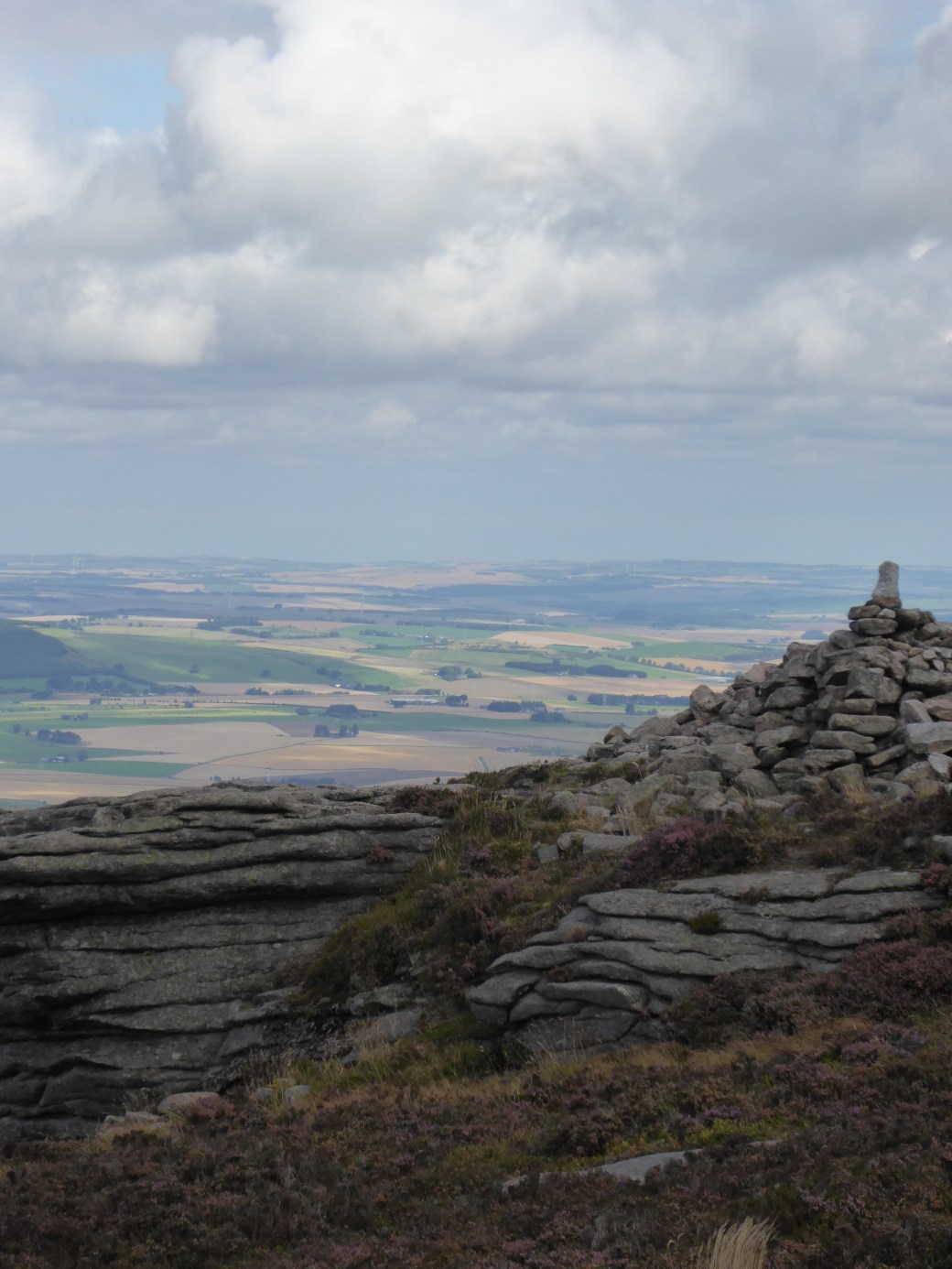
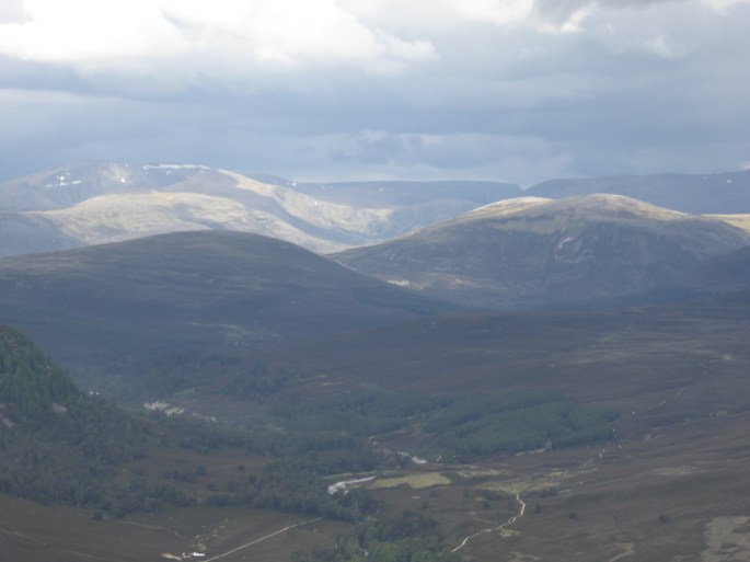
Recent days included a wander up Morven (871m) and a short, but fast ascent of Geallaig Hill (743m) from Braenaloin (both are hills near Ballater). Morven offered us stunning views of the surrounding springlike countryside, but the sunshine was deceptive: it was cold on the summit and most of my winter layers were required. Geallaig, a week later, proved to be equally as chilly, especially as the encroaching cold front complete with cloud and snow showers moved in to envelope the hill. The rapid change in conditions served to remind us just how raw the weather can still be in April. But the views (before we lost them) across to Deeside and Lochnagar beyond were superb.

P1010472

P1010470slide6

Memories Are Made Of This…. (‘Oh It’s Such A Perfect Day, I’m Glad I Spent It With Meeeee….’)

P1010292Some of my most intense memories come from days in the mountains. An elevated, different world, places that can’t be seen or imagined when you’re driving along the road through the glens. Days when time takes on different meaning, stretching itself out to the utmost while a vast number of experiences crowd their way into your memory.  The landscape that imprints itself on your consciousness. And all this, regardless of the weather – whether it be battling with the wind to reach a summit, traipsing across extremely boggy ground with rain lashing at you, in the sensory deprived environment that constitutes a white-out, friendly white cumulus clouds creating a chequered shadow pattern over the world below you or a day of wall-to-wall sunshine and intense blue skies.

P1010308
Looking towards the top of the Lairig Ghru


Yesterday’s forecast was extremely promising (how promising? Try Aviemore as the warmest place in Britain), and we actually succeeded in leaving the house early enough to be at the Sugar Bowl car park for a reasonable hour. Setting off on the first leg of our jaunt, it soon became apparent that we had different ideas about how best to use a stunning day like this. Iain was all for the ‘do as much as we possibly can’ approach – his actual comment being ‘seize the day by the neck and throttle it’. I wasn’t overly convinced by this somewhat go-getting attitude. After a number of days attending various full-on mountaineering courses this winter, I was much more of the mind to re-connect with the mountain environment in a visual and spiritual sense. Don’t get me wrong, I have thoroughly enjoyed all of my CPD experiences, but while on these courses there is little time to really revel in your surroundings. We rapidly approached the evocatively named Chalamain Gap, a boulder strewn ravine that lies below Creag a’ Chalamain (Crag of the Dove, the label ‘Chalamain Gap’ is a relatively recent one, not appearing in older literature), now associated with the 2014 avalanche that killed three people. It’s not the easiest terrain to negotiate, with huge blocks strewn about haphazardly. In wet or freezing weather, with a layer of snow or ice, it has the potential to really slow up any hill-goer. As we crossed the Allt Drudh and embarked on the climb in earnest, it was becoming clear that there was a conflict of interests, so once we were over Sròn na Lairige (1180m), Iain powered off to do his intended ambitious route of Braeriach (1296m), followed by Angel’s Peak (1258m) and Cairn Toul (1291m) – complete with nasty re-ascent on softening snow. My aim was Braeriach, but to have the time for photography without someone sighing every time I took out the camera, to perhaps take the opportunity to perfect some of my CPD work and to simply enjoy the views on this stunning, stunning day. P1010351On the way up to the Braeriach plateau, I stopped to exchange a few words with someone who was on descent. The conversation rapidly turned to Nan Shepherd and her writings on the Cairngorms. This is a book that sits at home, beckoning me to read it (once I’ve cleared the numerous things that stand in the way). I was intrigued to hear how inspired my fellow mountaineer had been by this publication – to the extent that he had been on a mission to swim in one of the lochs in Coire an Lochan – and had been extremely disappointed to discover that it was frozen over.P1010331

Continuing to the summit, the many different effects created by the snow were fascinating. The wind had sculpted in many senses: beautiful sastrugi, raised footprints, strange cornice lips were all the result of the wind. The recent history of wind direction and weather patterns was all evident here. The sun on the snow revealed icier patches in amongst softer patches. The views of Cairn Toul and Angels’ Peak across the Coire were amazing and I spent much time drinking in the panoramas.P1010339

It had been baking hot on the walk-in, but on the plateau the wind had picked up slightly and a significant number of layers were required (although Iain commented that on Angel’s Peak it was warm enough that he spotted one person in a t-shirt and another in shorts…at 4000 ft in March!). I headed over to the promontory to the south of the summit, before re-gaining the top and then deciding to start my return journey. Another viewpoint beckoned and I sat for another while, just allowing the day to wash over me. After all, there was no hurry. Iain had to be a very long way behind me, given his plan of action.

P1010361P1010419I ambled (no other word for it) downwards, wallowing in the luxury of being able to stop wherever, whenever. The sun was dropping and as I dropped down to the Allt Drudh I was deep in shadow. The sting in the tail re-ascent up the Chalamain Gap was not anywhere near as much effort as I had anticipated and I cruised up the path, noting the stunning orange glow of Lurcher’s Crag as the sun went down. Not particularly wanting to cross the Chalamain Gap in the dark, I had timed my arrival there to perfection.  As I paused at opening to the ravine, I thought how much the scenery was reminiscent of Tolkien’s Mordor – down to the bare, stunted tree that was struggling to grow at the entrance.

P1010432
The Chalamain Gap


My route choice through the boulder field was sound, but then I hit a patch of extremely slippery, peaty mud at the other end which put an end to my cleanish trousers and boots (yup, managed to sit down in the stuff!). Halfway across something behind me shifted and in the half-light, my imagination went into overdrive. Was that Gollum following me? Or something equally as sinister?  My pace picked up and I was very grateful to exit the Gap. The final 3km was uneventful, but I could feel the air temperature dropping rapidly and eventually I needed my headtorch. A final drop down to the bridge over the Allt Creag an Leth-choin and a last short pull up to the road saw me back at the car.  The sky was studded with stars and the longer you looked, the more you could see, the background stars seeming to come into focus.

So what of Iain? (apart from him trogging along singing ‘Oh It’s Such A Perfect Day’ to himself…and yes, he actually admits to doing this)  Well, he was tiring and repeatedly checking his watch for turnaround time on reaching Cairn Toul, flagging, with legs seizing up badly on return to Braeriach, sighing loudly on descent to the Lairig Ghru, slipping and stumbling in the pitch black through the Chalamain Gap and finally having to jog-trot the last half hour just so that we could reach the fish and chip shop, literally less than one minute before it closed (aware there might have been just a tad of annoyance if had we missed it and gone hungry due to his idea of a ‘good time’), not to mention whimpering intermittently on the drive back and barely being able to walk the next day. I think that in the grand scheme of throttle-stakes it was the day –  and not Iain – that scored a clear victory here.

Needless to say I was not greatly sympathetic….after all, we both had a pretty perfect day, whether we tried to seize and throttle it, or to just appreciate it. Memories are made of this.

[Note: The two song references in this post are to Memories are Made of This (Gilkyson, Dehr and Miller, 1955 – made popular by Dean Martin) and Perfect Day (Lou Reed, 1972); ‘seize the day and throttle it’ is a quotation from Calvin and Hobbes (Watterson); the Nan Shepherd book referred to is entitled The Living Mountain ( Edinburgh: Canongate, 2011)]

P1010328slide5