
A number of us in this life happen to be perfectionists – and those of us who are fully recognise that this trait can make us create untold difficulties for ourselves. We’re aware that we’re making our lives extra hard, but most of the time simply can’t stop our brains from questing for perfectionism. And so, when it comes to coping with fear, a perfectionist will put extreme pressure on themselves to deal with whatever that fear is in a textbook manner. This usually results in feelings of extreme dread or delaying tactics as a person psychs themselves up to deal with the issue, while at the same time settling for nothing less than the ‘stiff upper lip’ approach – not allowing themselves to show any sign of weakness as they tackle that fear. All this, rather than being sensible and reasonable – and cutting themselves some slack! The very title of Hugh’s next article, following on from his excellent first post for Places Wild and High (you can find it here), couldn’t describe this situation better: Admitting to the Fear (of Fear). Lots of food for thought here – I can already identify a couple of strategies that I will put into play once normal outdoors life resumes for me. So read, enjoy, and both Hugh and I hope that this article prompts much thought and discussion!
A ‘heads up’: some images of post-surgery, xrays etc. appear below.
Hugh writes: This is not the article I planned and promised to write about the physiology of fear. That one has stalled temporarily due to a busy few weeks and not enough time and headspace for writing. But I did find time to have a personal breakthrough that I thought was worth sharing.
I am a keen road cyclist and last August I had a pretty major off that broke both me and my bike. I am a pretty fast descender and, while I don’t think Tom Pidcock has much to fear from me, there are some local hills that I do actually have faster times on than some of the pros who trained around here during the UCI World Championships held in Glasgow in 2023. To go any faster on some of the descents that I know well I would need a more aerodynamic bike, higher gears and – especially – a complete disregard for the fact that cars might be coming up the road and around blind bends. I am not boasting about my skills, just highlighting the fact that fear of crashing at high speeds on a road bike has not held me back. But until a couple of weeks ago I feared that might have changed.
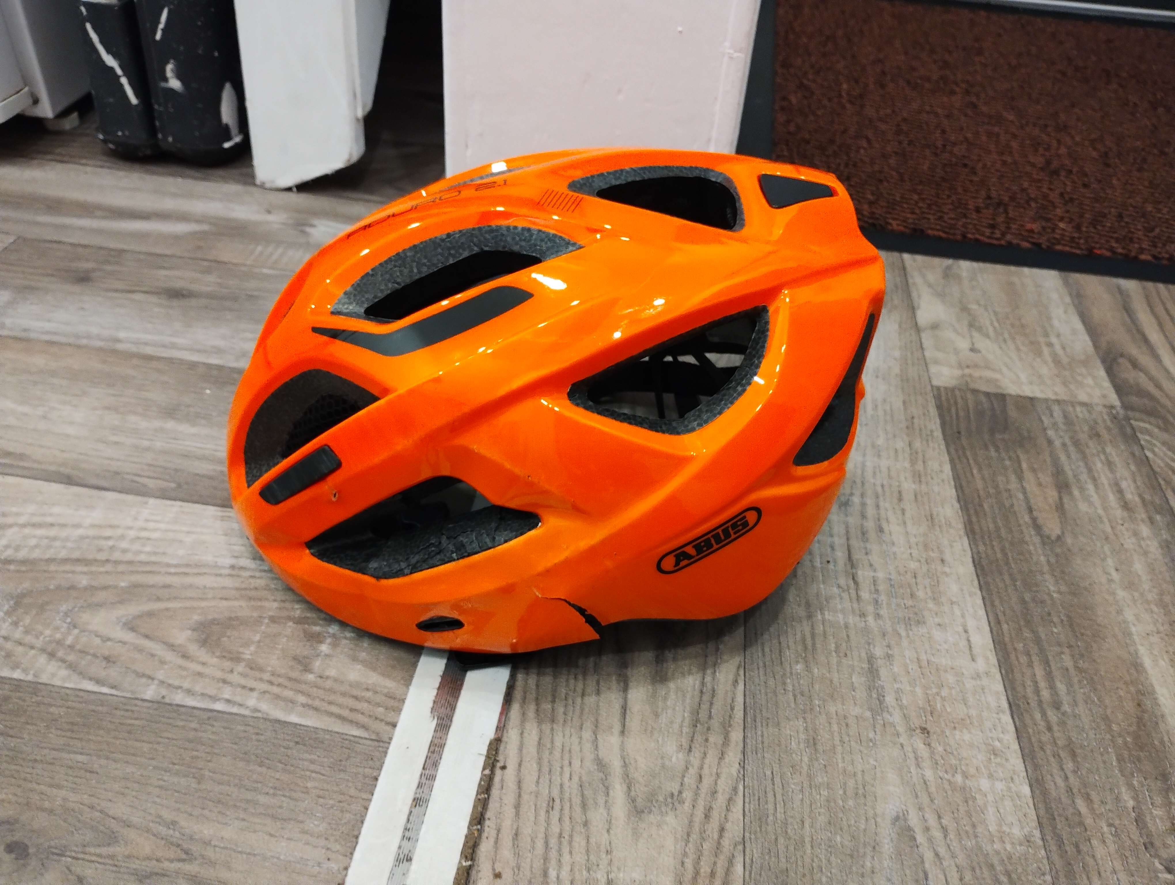
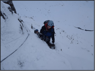
Last August I was out on a club ride and coming down a road I know well in my usual style. As I neared the bottom, a car was starting to come up the hill so I moved over a bit to give it plenty of clearance. The car also moved over and there was plenty of room for us to pass safely so, while I covered the brakes, I didn’t feel the need to back off at all. I don’t think it would have made any difference if I had, because crashing at 25-30mph would likely have resulted in much the same outcome as the actual 36mph crash did. I failed to see a pretty innocuous pothole until my front wheel encountered it and all I have is a visual snapshot of my wheel kicking 90 degrees to the left and the next thing I know is I am on the ground. I had come to rest 45 feet from the pothole and must have tumbled and slid a few times to get there. Meanwhile my bike was a similar distance further down the road with a buckled front wheel and a couple more scraped bits. The car driver was good enough to stop and give me a lift home and my two club mates made sure my bike was taken home too. I broke my left collar bone (it was displaced by 2cm and was surgically repaired); had a slightly collapsed left lung (which kept me in hospital for observation for a couple of days); fractured the tip of my right pinkie finger; and had bruises and scrapes to my elbows, knees, hip and knuckles. My cycling clothes were shredded and my helmet was smashed. If I hadn’t been wearing a helmet I am sure that I wouldn’t be writing this today. With luck I would have been killed outright, otherwise I think it is highly likely that I would have suffered a traumatic brain injury. As it was, I didn’t even lose consciousness, get concussed or have any serious after effects, though I did develop vertigo (which worried me for a while as I thought it might stop me riding a bike again) but even that has essentially gone away. I am a personal trainer with my own gym so I am now pretty much physically rehabilitated, barring a few scars and tender spots.


But this article is about fear, not physical injuries. The first bit of fear I really encountered was a week after the crash. I crashed on the Thursday evening and was in hospital until the Monday. The next Thursday I was sitting watching TV and very aware of my breathing and feeling breathless. Being a former ambulance technician, I have a lot of medical devices, a modicum of knowledge and access to Dr Google and, by the time I had taken a few measurements, I was convinced I was in respiratory distress so got my wife to take me back to A&E. Long story short, there was nothing (further) physically wrong with me (even though I’ve never seen my blood pressure that high) and they sent me home again. I’d had a panic attack.
In the immediate aftermath of the crash I was in my cool, calm, collected emergency services persona that served me well in a previous life. The medics at A&E remarked on it both times I visited. I have always been unusually calm in the face of immediate danger but that doesn’t mean that I am not experiencing fear even if I am generally good at controlling it. And that is something for those reading to bear in mind: if you or a companion experience danger or trauma, the fear may not manifest at the time but might emerge later. There can be an assumption that those who appear fearless are unaffected by the events but that is rarely true. You or your companion may have adelayed reaction – that can manifest in physical signs and symptoms (more on that in the article I should be writing) – quite some time after the actual events. So please be kind to yourself and ask for support if you need it and check in on your friends in the days and weeks afterwards and don’t assume that because they appear calm that everything is ok.

For me it wasn’t until after I had got home from hospital with a repaired shoulder that I even thought about my head and how close I had come to being killed or worse. Being killed at work or during a recreational activity is something I have always understood and accepted intellectually but it is different when an abstract idea is faced in reality. And that took a bit of processing over the last few months, though most of it in the background of my mind, not as a conscious effort or as a therapeutic course of action. I was told to be off the bike for 12 weeks (I know some pros are back racing the day after surgery for identical injuries but they get paid to ride their bikes while I do it for fun) which took me to November and I don’t really ride much over the winter anyway (as I said, I ride for fun) so it wasn’t until the New Year when I started to think about getting back on a bike and properly realised that I was a bit apprehensive about the idea. But I had plenty of good reasons (and a few flimsy excuses) to keep me off the bike so it wasn’t until well into February that I really started to confront the fact that I was a bit more than apprehensive about riding again. I wasn’t worried that I could ride a bike but I was worried that I wouldn’t be able to ride it well enough to make me happy and riding downhill fast makes me happy.
To compound all of this, I manage a cycling club (Ride 63 for anyone who is interested http://www.ridesixtythree.net) so my not loving cycling impacts others too. At a committee meeting in February I admitted to my fellow Ride Guides that I was suffering from a loss of mojo and was met with plenty of sympathy and support. My club is not a traditional road racing club with a ‘toughen up’ mentality so I wasn’t surprised about the care shown but it is always nice to receive it. But as a club we are not all touchy-feely and some of us are more open with our lives than others, but we are a self-selected community of people who have gathered together through a shared interest and love of cycling and have become friends. Overcoming life’s difficulties often takes the support of family and friends but sometimes it comes from our community of acquaintances who might surprise us by stepping in to offer support when sometimes those closest to us fall short of our hopes and expectations. But to receive help you might have to ask for it or at least be open to sharing if things aren’t going well for you. Unless someone knows us very well they probably will not pry into our state of mind because they care about us (and don’t want to intrude), not because they don’t. I’ve learned this lesson several times in several walks of life to the point that I am now open and vocal about mental health in the workplace and life. People are often very quiet about mental suffering because they perceive that they will receive ridicule rather than support (and that does happen) but more often it seems that one person opening up allows others to do so as well. We can all think we are alone in our suffering while not realising that there are many more like us. It takes bravery to admit that you are scared but, if you haven’t already realised it, you need to experience fear in order to have courage: fearlessness is not the same thing as courage at all.
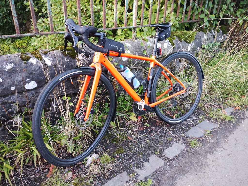
By mid-March I had still not got on my bike but I had run out of excuses as I had (at last) serviced my summer bike (the winter bike that I crashed last summer is still waiting to be fully repaired – what can I say – I am a champion level procrastinator) so on 18th March – almost seven months to the day after my crash – I went for a bike ride. I had not consciously considered riding past my nemesis but maybe my subconscious was at work because my planned route took me very near to the base of the hill. I had walked the site a week after the crash and I’ve driven past it a few more times as well but I would be lying to say I wasn’t concerned about riding it again and knew it was something I was going to have to confront eventually. But about a mile into the ride I was struck by the thought that I would regret not riding straight up and back down that particular hill so that’s what I went and did. I rode up past the pothole (now properly repaired after me putting some pressure on my local councillors) and turned around at the top of the steep, wee hill. I told myself I wasn’t to try and break any speed records but I wasn’t to hang back either and I was not to brake unless I actually needed to. I covered the brake levers (as I always do) and had to control the urge to use them but I got up to 35mph as I went sailing past the site with a grin on my face! 20 miles later I got home with an even bigger grin and a week and a further 100 miles later I know my mojo is back – even if my fitness is not! – and I am apparently descending as fearlessly (and cautiously) as I ever did.

I don’t need to match my top speeds in order to have fun on a bike and I am sure I will forevermore have an extra voice in my mind reminding me that crashing hurts. But I also know that the very reasonable fears I have been living with for the past six months were easier to overcome in reality than I imagined them to be. Was that because I had spent time contemplating those fears or did I contemplate them too much and blow them up out of proportion? I certainly didn’t need therapy to overcome my fears (this time) but that’s not going to be true of others or me next time (fingers crossed that there is no ‘next time’). None of us know how we will feel and behave in the moment until we are in it. I believe that mentally rehearsing dangerous and scary situations allows me to control them better in the moment but I can’t be entirely certain that it really does, because dwelling on one’s fears can amplify them well out of proportion too. Anyway, enough writing for now. I have to get myself into the workshop to repair that poor bike that has been languishing in the shed for too long. (And for all you true cyclists reading this you will be glad to know that bike suffered less damage than I did.)


@strengthforhealth
@stravaiging_cyclist

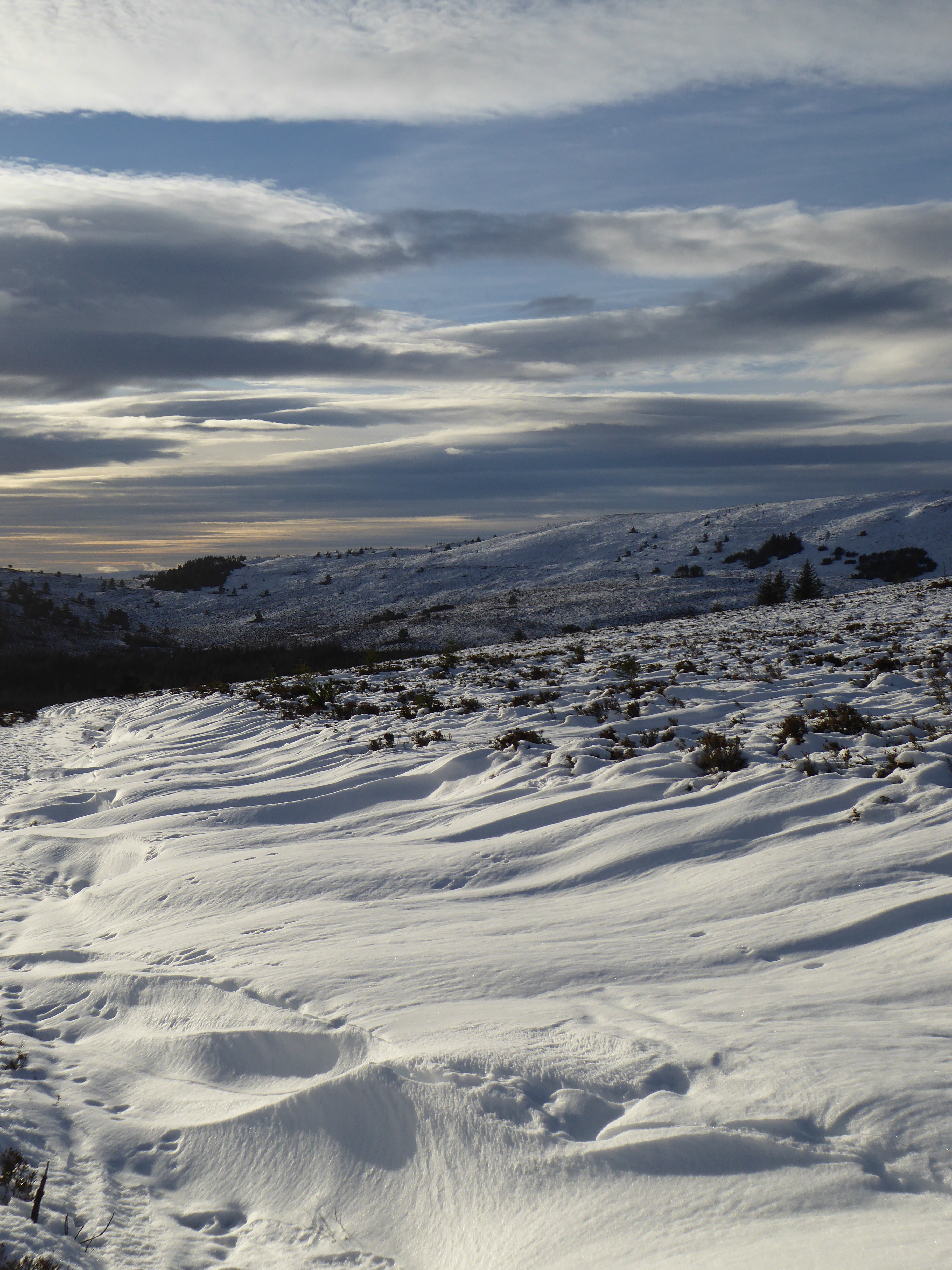
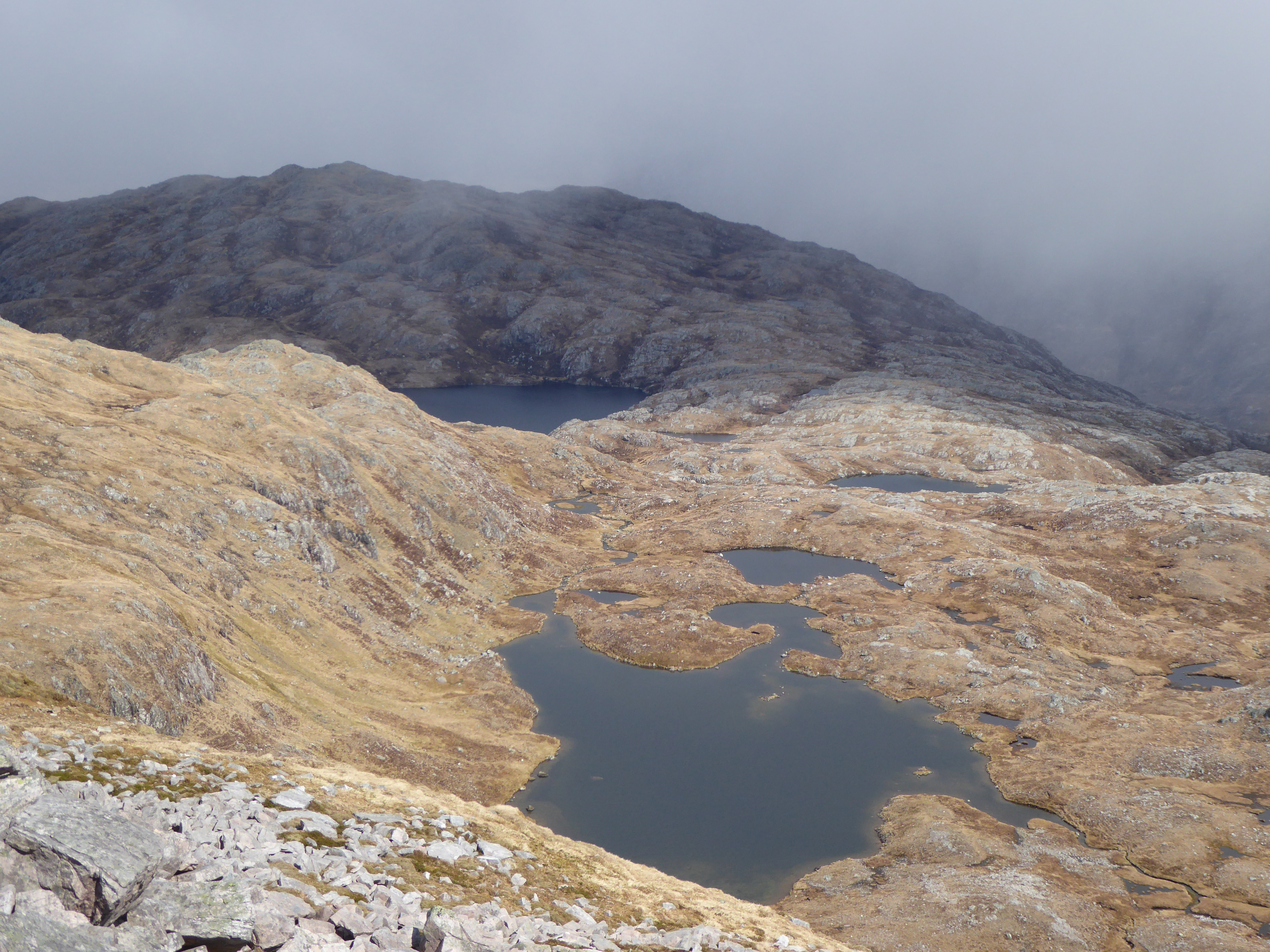


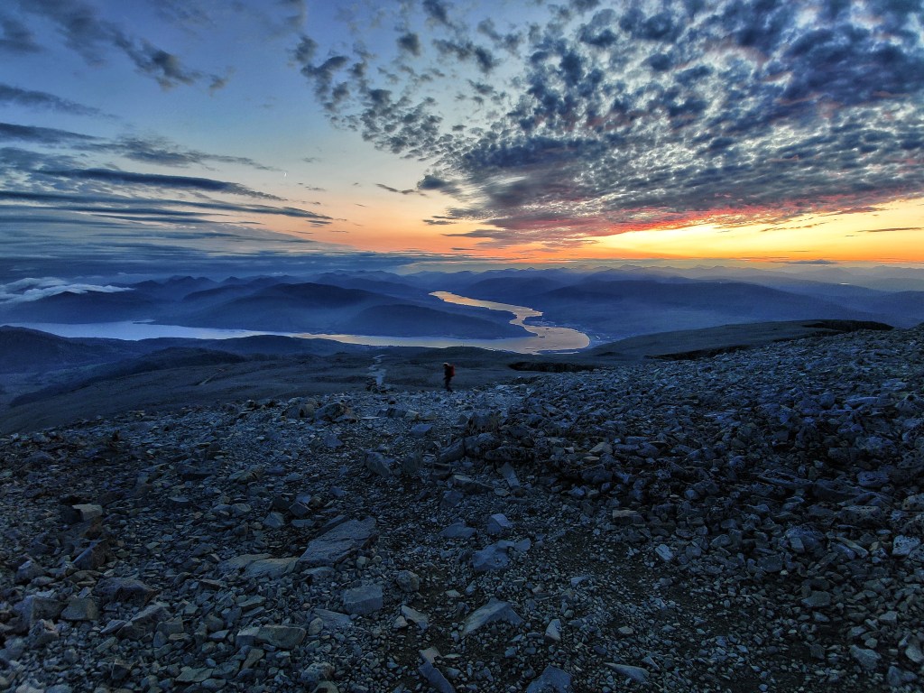


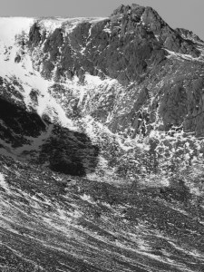


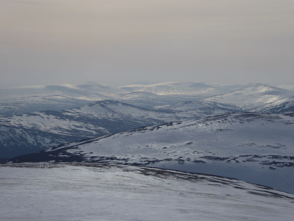
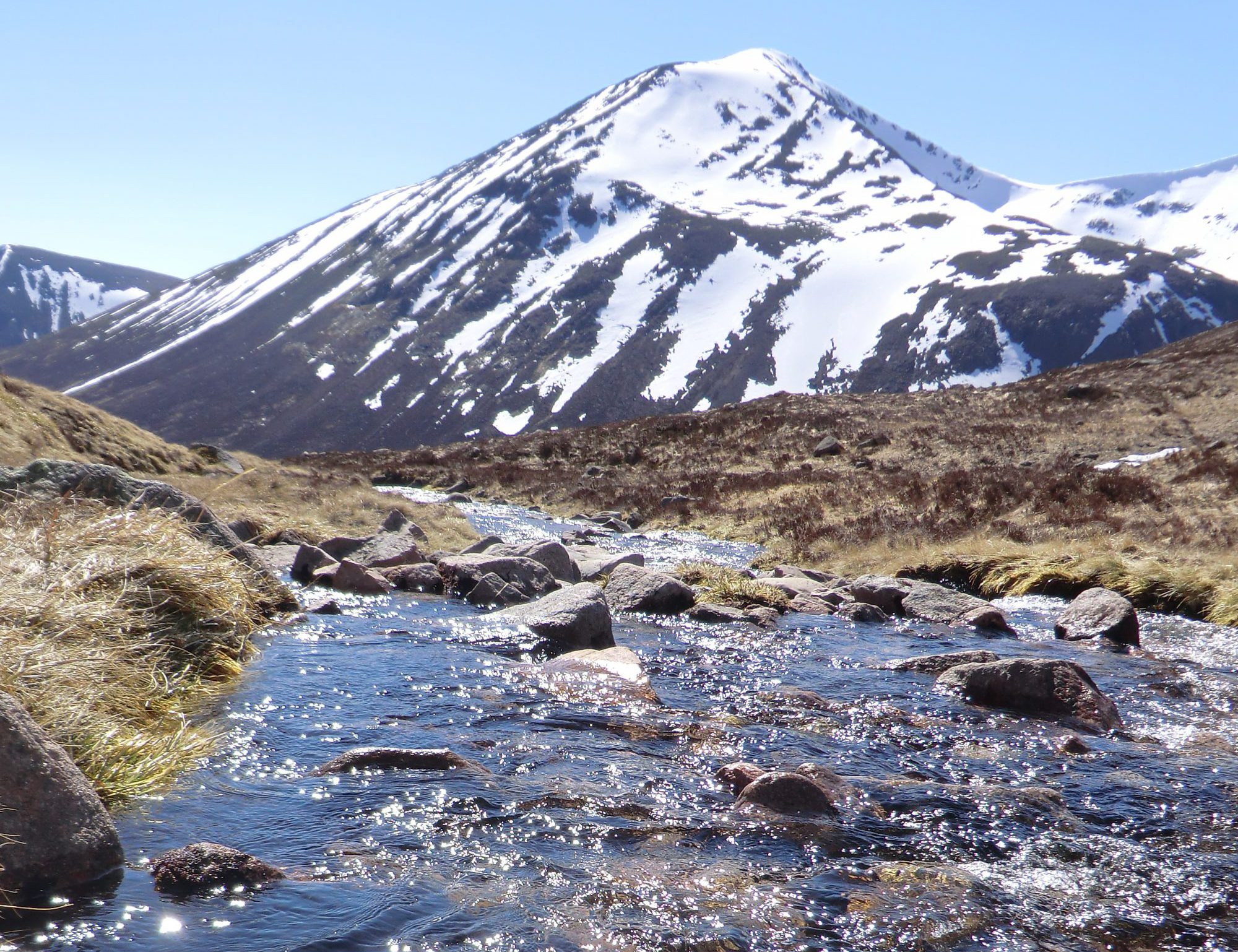
 It was already starting to snow as I headed to park the car at Linn of Dee and intermittent flurries continued all the way to Derry Lodge. As I headed up Glen Derry, it really started to come down, and as I headed for the col between Meall an Lundain and Beinn Bhreac it continued to get heavier. Underfoot conditions were incredibly hard going. I was constantly sinking up to my thighs in wet, heavy snow, hauling one leg out, shifting my weight only to sink deeply in again, this time on the other leg. Beinn Bhreac in summer is a nice easy and relatively short Cairngorm day, but on this occasion, it turned into a mammoth undertaking. It took me two and a half hours to cover the mere 2.5km to the summit. The falling snow was relentless, higher up the wind was really battering the top of Beinn Bhreac. The endless effort of taking steps was incredibly draining. As I slowly ploughed my way back to the main path it became evident just how much snow had come down while I had been out. The walkout from Derry Lodge was in the dark, by this stage the winds had dropped, the skies had cleared and the waxing crescent moon provided more than sufficient light for me to see where I was going.


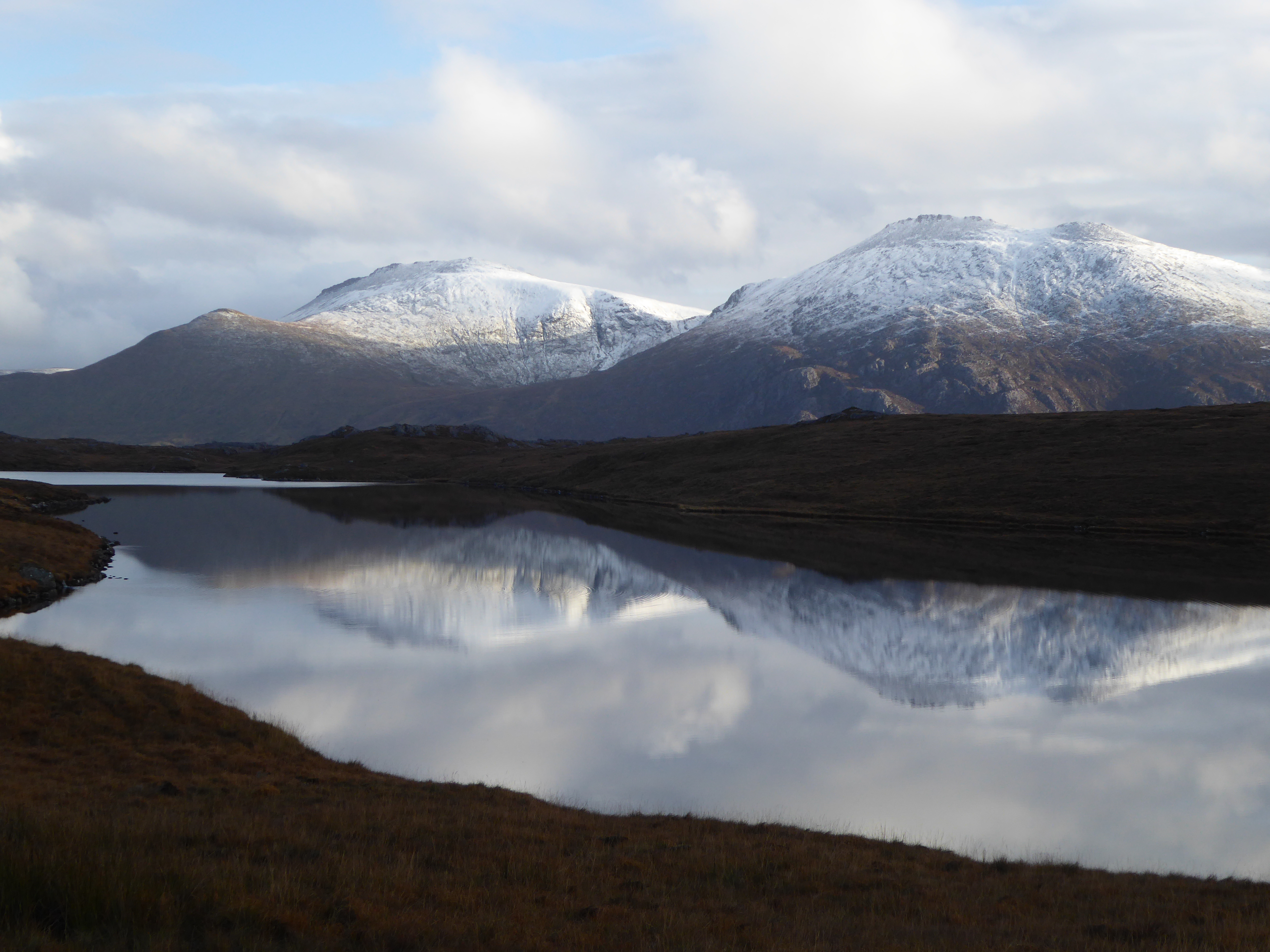
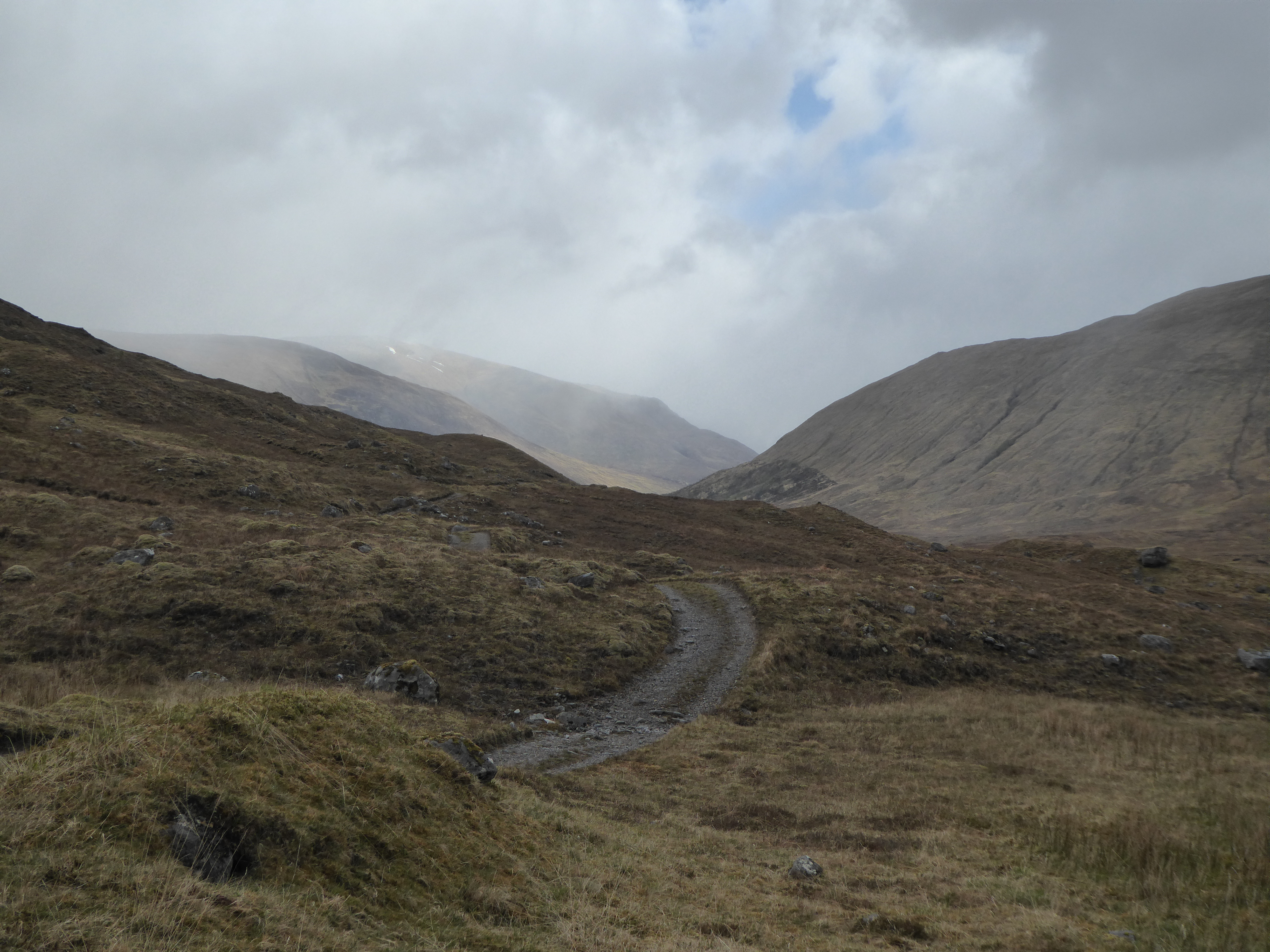
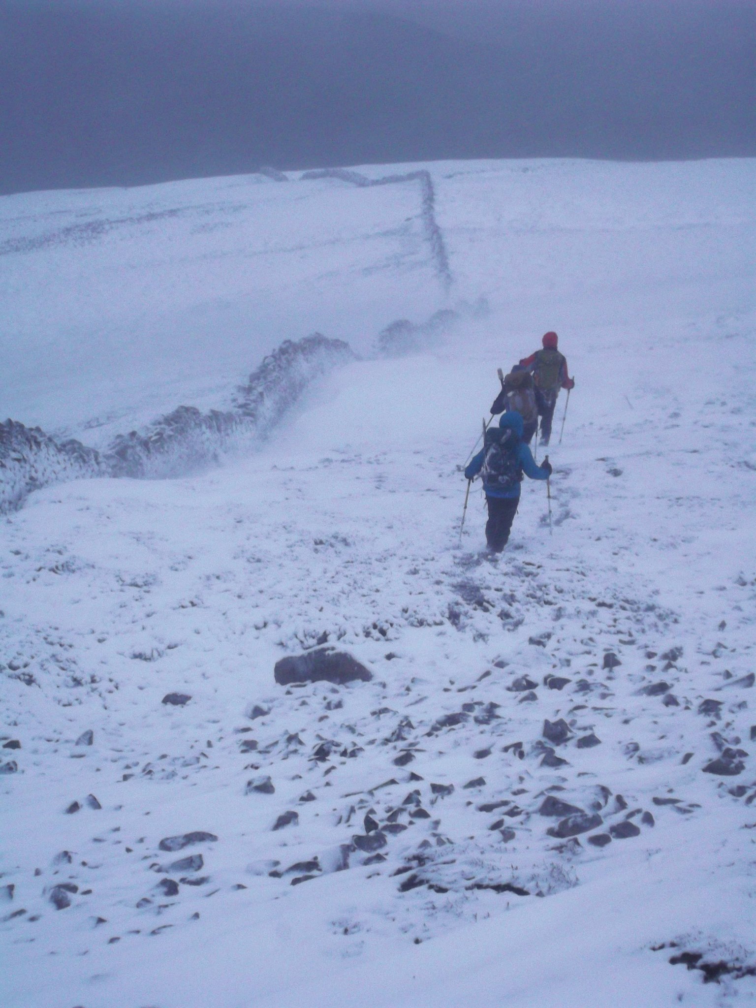
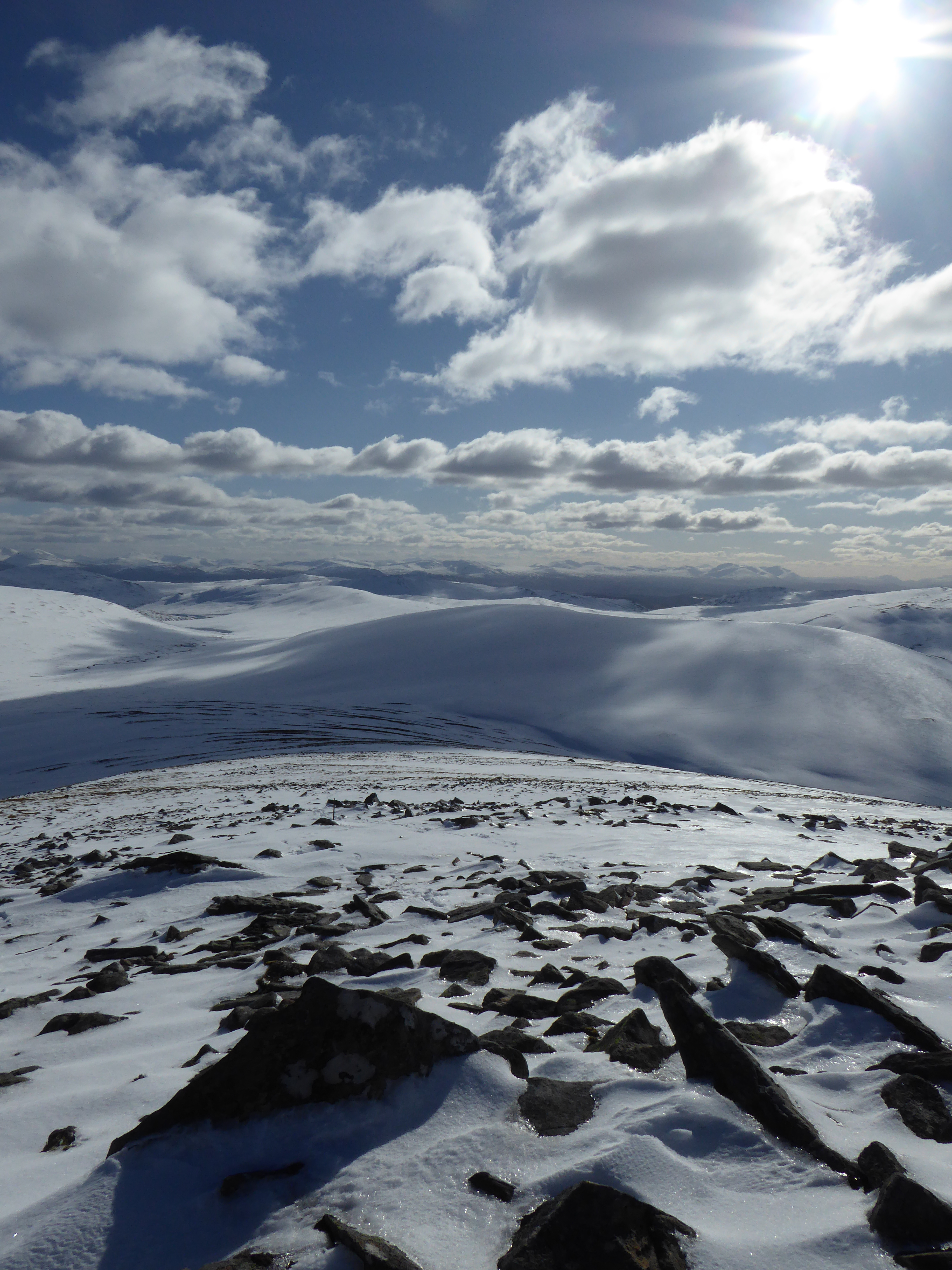
 I was constantly needing to check that I was walking in a straight line by checking the back bearing. Slow progress. I reached my turn around time, but decided to ignore that – I had a head torch, I knew where I was, I had a realistic idea of my return route, I knew what the snow conditions were like, I knew which slope aspects I needed to avoid, I knew that I had to be alert (!) to changes in conditions, I was prepared to walk out in the dark – so I went on. Slow progress on Monadh Mor, but eventually, by my reckoning, I was on the summit ‘ridge’. Of course it was near impossible to see too much, but I located the summit cairn (heavily disguised by snow), took a very brief breather and started back down and across the Moine Mhor. The advent of night caught up with me as I was making very slow progress back to the col area near Carn Ban Mor. The moon showed itself briefly as I stopped for a couple of short breaks to deploy axe and crampons for descent – followed by the 5km walk out. Late back to the car (later than Iain) and very late back into Aberdeen (which is a long way from anywhere at the best of times).


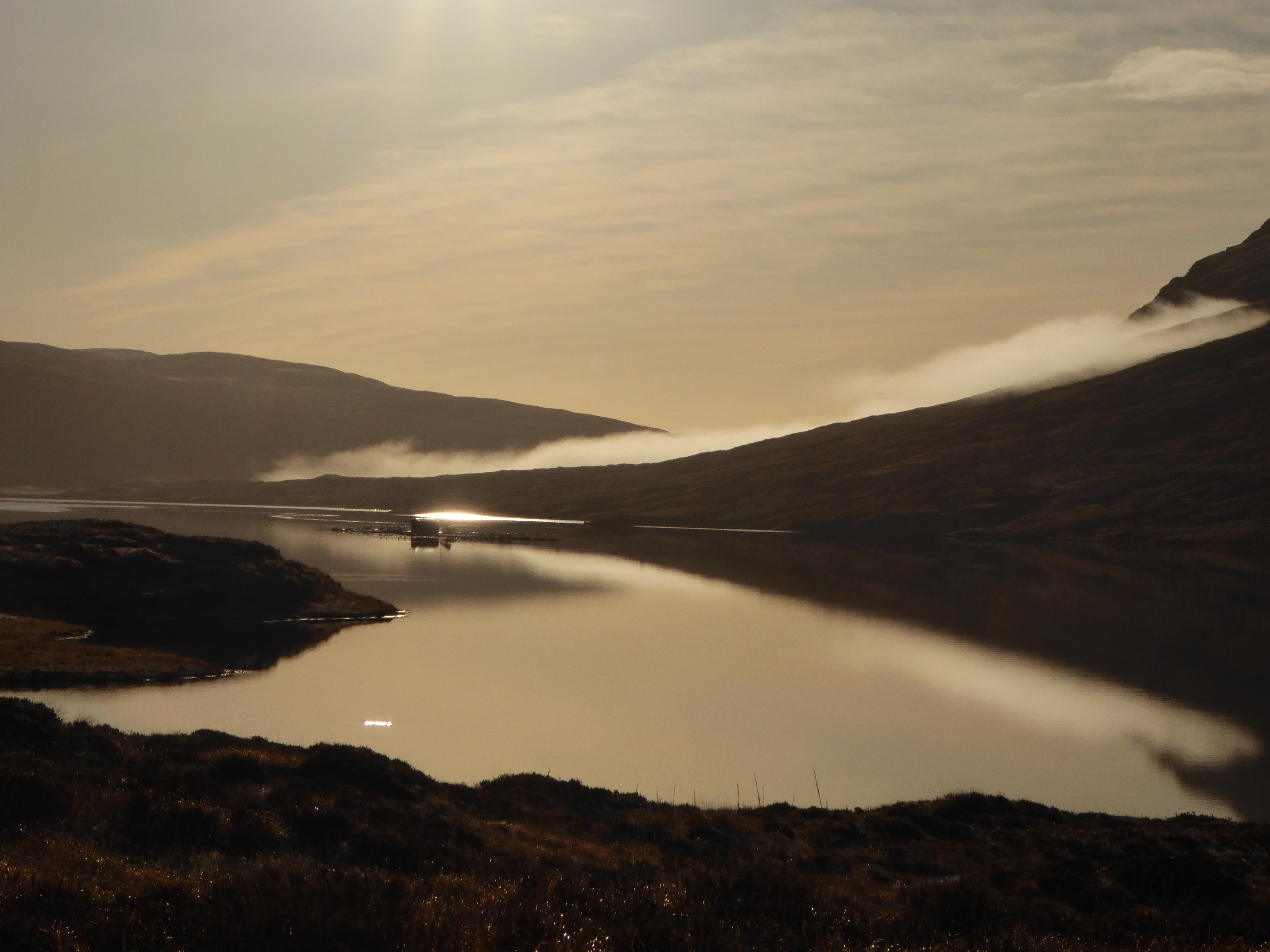
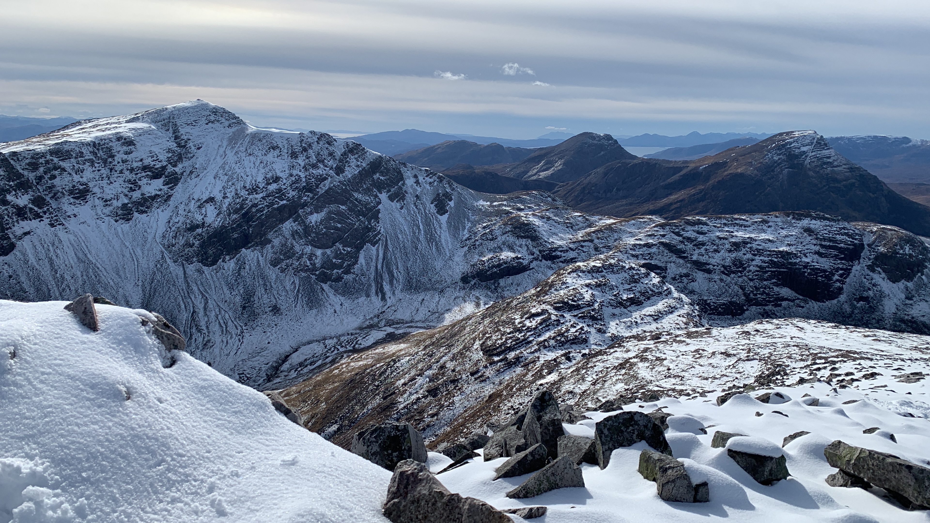
 bound, ethereal beauty of the main Cairngorm massif was deeply moving. It was a bittersweet experience, knowing that we would have to accept that we were not going to see these mountains for a very long time, but that we were incredibly privileged to be out there right there and then.