The wind at the North and East
Was never good for man nor beast
So never think to cast a clout
Until the month of May be out
‘Ne’er Cast A Clout Till May Be Out’ is an old adage that is well-known and often quoted throughout Britain. The rhyme was originally recorded by Dr Thomas Fuller in 1732 in his Gnomologia, while the version cited above appears in F.K. Robertson’s Whitby Gazette of 1855. The word ‘clout’ refers to clothing (think ‘clootie dumpling’, the traditional Scots fruit pudding which is boiled in a cloth). The implied meaning is not to cast off your winter clothing until ‘May Be Out’. The latter half of the phrase is widely debated, the typical interpretation being that one should wait until ‘end of May’ before storing all those winter clothes. However, the hawthorn tree in days gone by was known as ‘May’ or the ‘May Tree’ and hence it is thought that the saying relates to when the hawthorn puts forth blossom rather than referring to the end of the month.
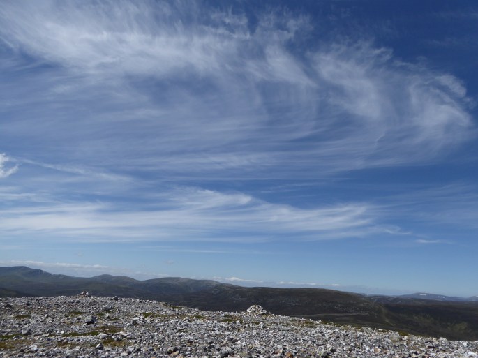
 There were very definitely no flowers on the local hawthorn trees when I left Aberdeen for the West. In fact, on arrival at Ratagan, ten minutes sitting at the lochside with the odd swift hail shower ushered in on a northerly inclined wind was enough to convince me that it was better to admire any views from inside the parked car while I waited for the rest of the expedition party.
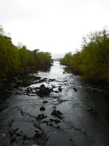
A through-route always requires logistics. This occasion involved four people travelling from two different cities, two cars, three persons’ worth of luggage for a weekend of mountaineering as well as full packs for all four of us for the two day exped. The result was a major reshuffle of a hair-raising amount of luggage (a staggering proportion of it was food) before the car that was going to take us up to our start point was finally ready to depart.
Like any good expedition there was a just a hint of nervousness in the air as Joan (Thoughtful Navigation, A Very Special Client…) drove the 70 odd miles round to the River Affric car park. This was a serious birthday expedition (Happy Birthday, Mary!) – serious in the sense that all the formalities of a birthday ‘feast’ supplies were to be carried with us to the very remote hostel (the cake was the only thing that didn’t go with us). Pauline (When Grahams Come Into Their Own) was carrying a bottle of champagne, while I had the evening’s main meal – carefully prepared stuffed peppers, with accompanying tahini sauce. After painstakingly preparing everything the night before, I had been somewhat taken aback to realise that the filled peppers were extremely heavy. As Mary (The Tale Of Mary And Tom Buidhe) pointed out: that’s what happens when couscous is hydrated… Mary seemed to have a very good supply of gin and mixers with her… she certainly had sufficient to allow for a very civilised G&T with her lunch the following day.
Disembarking at the carpark was a shock to the system. It was cold, damp and felt slightly raw. ‘Be bold, start cold’ is a common saying in mountaineering circles, but we all ignored that pearl of wisdom and layers were piled on. Still semi-seriously considering downing the champagne, and a few gins for good measure before setting off – until one of us pointed out that we probably would be too insensible to even find our way out of the car park – we headed off. A backward glance at the car, and then forward – and we were committed to our adventure.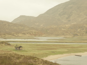
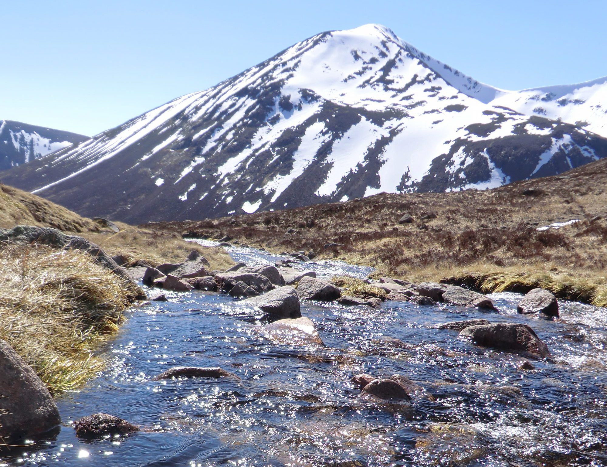
The Affric Kintail Way actually starts in Drumnadrochit, wends its way to Cannich and then up to Glen Affric (Gaelic: Gleann Afraig. Glen of the Dappled Woodlands) itself. The Glen is generally considered one of the most beautiful in Scotland: it is a National Nature Reserve and also a Caledonian Forest Reserve. Despite its beauty, the Glen has not been left untouched by development, forming part of a hydroelectric scheme. The original proposals (dating from as early as 1928) suggested that Lochs Affric and Beinn a’Mheadhoin should be joined to make one huge dam. But eventually it was the parallel glen to the north where the River Cannich was dammed in 1951, flooding and drastically expanding the original Loch Mullardoch. From there the water runs via an underground power station and by tunnel to Loch Beinn a’Mheadhoin (also dammed) in Glen Affric. Then the water travels by tunnel to the Fasnakyle power station near Cannich. Loch Affric remains natural.  Due to good management and some foresight, the Glen has survived well as a natural living landscape, despite the intrusions of the hydroelectric scheme. The Forestry Commission (now Forestry and Land Scotland) took up management of the Glen in 1951 and, in the wake of the Second World War, after initially starting to grow non-native trees for commercial timber purposes, had the good fortune to be managed by one Finlay Macrae: an enlightened forester, Macrae repopulated the Glen with native Caledonian pines. During his time at Affric it is estimated that he planted some 8 million seeds. The development and preservation of natural forest continued as priority with careful management of red deer numbers on the estate and the eventual removal of all commercial timber plantations. As a consequence, the native forest mixture of Caledonian pine, birch, alder, rowan, hazel, and juniper flourishes here.
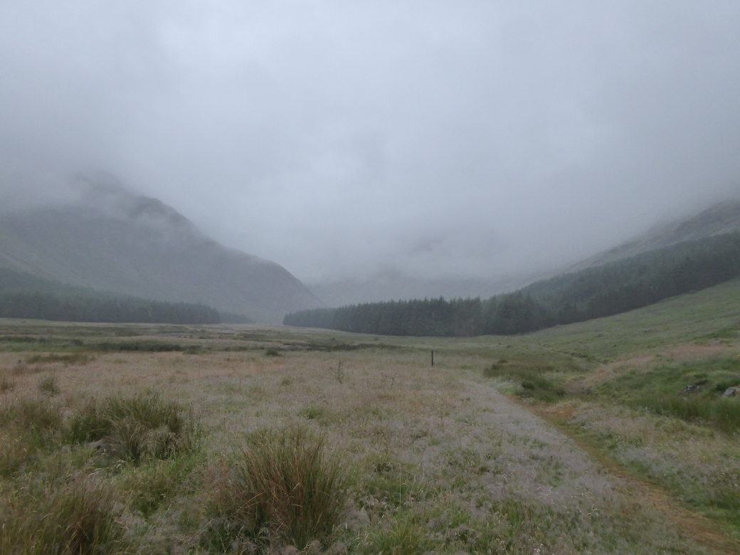
This section of the Affric-Kintail was has always been a traveller’s route – and also old drovers’ route (cattle were driven from Skye to markets (trysts) in the south via these glens). The lonely atmosphere that we prize so much as modern people came at a price for those that lived here during the time of the clearances. There remains little trace of human history along the way: the odd lonely ruin reminds of the existence of people and hints at the importance of this route in the past. We followed the track along the south shore of Loch Affric weaving amongst beautiful wooded areas and eventually emerging at the far end, where the trees fade out and the scenery becomes bleak. We crossed the bridge, passed Strawberry Cottage and continued on our way, eventually reaching Alltbeithe (Birch Stream) Youth Hostel mid-evening.


On arriving we were greeted by the news that the only two twin rooms in the hostel were available for upgrade if we wished – good news indeed – none of us was going to turn that opportunity down! The excellent custodian of the hostel, Hannah, gave us the complete tour of the place and in no time at all (it is after all a very small hostel!) our little party settled down in the common room area for G&Ts, champagne and food (I was immensely grateful to see those stuffed peppers disappear – that would make a difference to my load tomorrow. I’m sure that Pauline felt the same about the bottle of champagne). Hannah spends three weeks on duty and then one week back at home during the months that Alltbeithe is open. She has wonderful tales to tell about experiences at this remote hostel and is responsible for the running of the place, having the exact skillset for the post: from clearing blockages in the stove chimney (no mean feat) to advising unprepared travellers, to exquisite embroidery skills that feature on cards for sale , she is resourceful, hospitable and completely at home with the vastness of the surrounding landscape and remoteness of Alltbeithe.


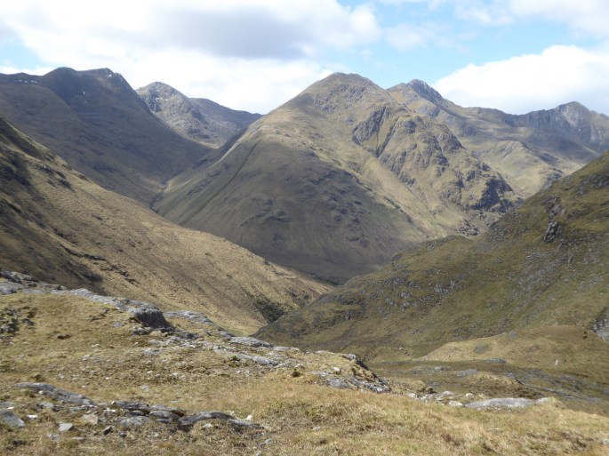
The weather on our first day had been pretty benign, but as we set out from Alltbeithe, the initial sunshine disappeared, the cloud base lowered and we were soon subjected to intermittent hail, sleet and snow showers. It was cold, no two ways about it. Alltbeithe, as I looked back, seemed dwarfed by the immenseness of the scenery. We followed the track upwards towards the Fionngleann. The sprawl of Beinn Fhada and, to the south, the distinctive shape of Ciste Dhudh dominated either side of us initially. We headed past Camban Bothy, after which the track turns into a path, reaching the watershed by Cnoc Biodaig not long after.


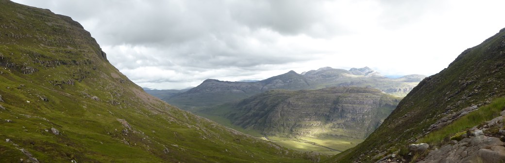
Twisting and winding, up and down over moraines, scenery around us was changing from the bleakness of the more open glen to the spectacular vistas of Kintail. Eventually the path started its descent towards Gleann Lichd, passing a spectacular waterfall and taking us down, down, down, only about 300m of descent, but feeling like much more.


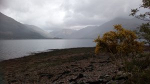
We could spy Glenlicht house in the distance and eventually it loomed large in front of us, complete with a change in weather. Naturally it was warmer lower down, and we were more sheltered, but suddenly the sun decided to put in an appearance as we powered our way up the Glen, towards Morvich. The final sting in the tail, however, was the 5km walk on the road (including a stint on the main road) to retrieve my car.


The encounter with warmth was to be shortlived. As I drove Joan back to the River Affric carpark to retrieve her car, I watched in disbelief as the temperature gauge on the car steadily dropped from a reasonable 12C at Ratagan to 2C at Cannich – and then 1C as we approached the car park. The possible-ice-on-road warning light had come on by this stage and it was trying to snow. I was highly appreciative of my winter jackets that I had selected for this trip – not a luxury, but rather more of a necessity: ‘ne’er cast a clout till May be oot’ certainly rang true on this occasion.


[Finlay Macrae had been a student of Professor H.M. Steven (Aberdeen), who was joint author (with A. Carlisle) of The Native Pinewoods of Scotland – which highlighted the significance of Glen Affric.
Sources:
https://treesforlife.org.uk/news/article/glen-affric-ndash-60-years-wild/
http://www.affrickintailway.com/index.html
https://idiomation.wordpress.com/2010/03/30/never-cast-a-clout-until-may-is-out/ ]


 More navigation practice last week: out in the Glen Clova area … this time with not-so-good visibility up high (ideal for putting all those navigational techniques to the test) … and finishing with a hefty shower that started 20 minutes before we got back to the cars. After the last time (


 The pain is immediate and I roll (as best I can) onto my back in reaction to the impact. For a few seconds I lie there as my nerve network clocks what’s happened. My companion, who is slightly ahead, turns to see whether I’m alright. I try to get up but feel so sick and dizzy that I collapse back onto the track. After what seems like an age (but probably wasn’t) I drag myself backwards, to park my backside on the embankment at the side of the track and sit there. Failure to get up from where I’m sitting is simply not an option. I need to be able to walk out of this. ‘Broken knee cap, broken knee cap, broken knee cap’ goes through my mind like a chant. With effort I launch myself, find myself able to stand, and, miracles of miracles, my right knee takes my weight. 9km to the car, I tell myself. You have no choice. You’ll just have to do this. The knee has become a numb non-entity, but within 2km the pain is kicking in and the joint is swelling rapidly.


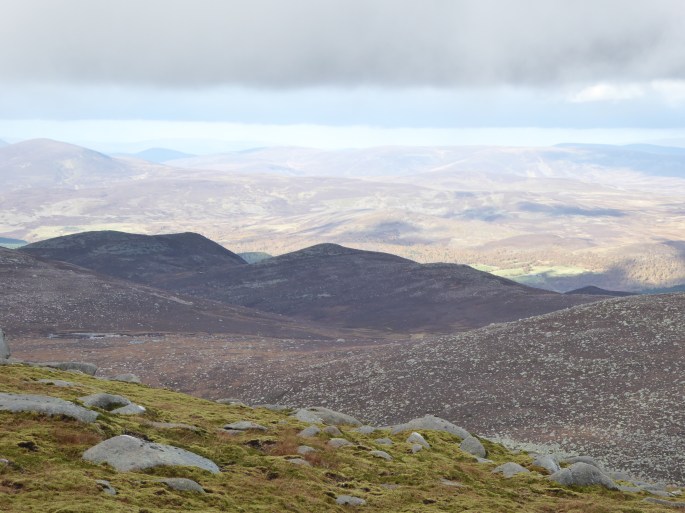
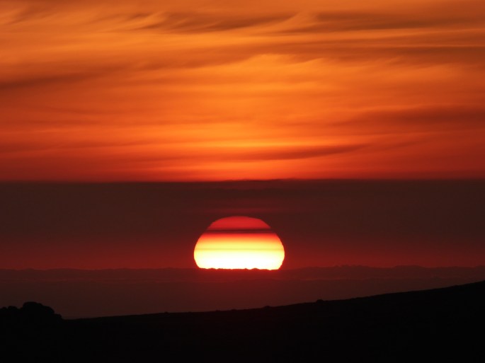
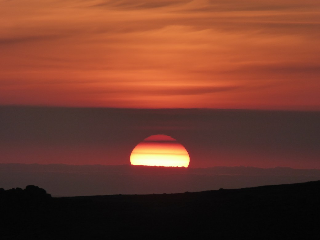
 Towards the end of our sustained climb, the waning quarter moon appeared over the shoulder of the mountain and as we approached the edge of the Corrie, the mist was rising upwards, with pre- sunrise hues painting the North Eastern skies, while the lochans down below reflected the moonlight above. Over to the North Summit the colours grew more intense around us. A herd of deer grazing near the summit were certainly very startled to see us and moved off rapidly. The mist brewed and boiled down below in the glens and corries. The sunrise gradually progressed, the paler shades deepening and preparing for the stunning, red ball of fire that eventually lifted itself above the horizon. The moon started to lose its wonderful silvery sheen and the power of its light diminished as it became a whiter shadow of itself.


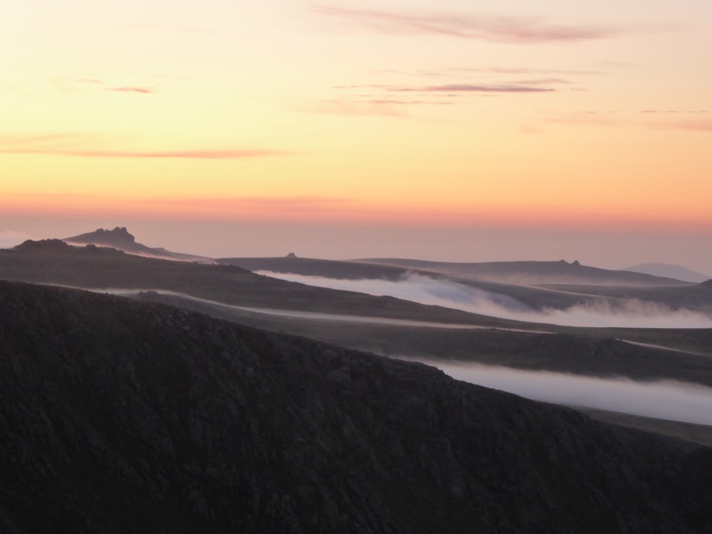
 A mountain hare abruptly sprang out of the grass: we had been so close to him that we could, for a brief second, see in detail his eyes, whiskers, nose and coat. Clearly a youngster, he raced off down the path ahead of us. The temperature was rapidly climbing and we gratefully dropped down into the cloud that was resting in the glen, making things far more bearable. This just left the walk out, with that very surreal feeling that comes with finishing a lengthy mountain ‘day’ when everyone else is just starting theirs.


 ‘Hot’ doesn’t even begin to cover it. Even in the shade of the trees walking was tough. There were several stops (by the water) for Harris to cool down, but also for us to rest. As we climbed higher and above the treeline, the heat became worse. No drop in temperature with gain of height today. No cooling breeze. We made it as far as the spot height at 727m, where Harris very patiently followed us around while we discussed slope aspect, before we decided it was simply too hot to continue – primarily for Harris, but also for our sakes.


 Fortunately common sense got the better of me for once and I took the direct route back up the glen. Amusingly I later spoke to someone who had the same thoughts as me but had been armed with a bike and thus cycled through to the pub (though I believe the beers did not sit all that well with him after that). Anyway, next morning nothing was going to stop me – a quick up and over to Glas Bheinn and back to collect the tent, before finding a suitable compromise between distance and altitude to get over Leum Uilleim again and down to the Station House….where I was greeted with a sign that said it was closed from 4.30 to 6.30 pm for a large party. To say I nearly cried would be an understatement. Fortunately I was just ahead of the 4.30 embargo and they were happy for me to eat outside (no complaints there, bit breezy but a stunning day) if I ordered immediately, and they indicated that keeping me supplied with drinks would not be a problem. After all that anticipation neither the food nor drink let me down (though the beers may have played a part in my later navigation errors). Once satiated, I headed over the Loch Ossian in the glorious evening sunshine – meeting lots of people staying in the youth hostel heading to the pub for their dinner – and promptly took the wrong path (aiming to take the main track back to Rannoch, camp at a ruin at 500 metres, zip up Carn Dearg the next morning, back down to collect tent, and walk back to Rannoch station).


 Our strategy was then to walk back to Torridon along the road from there. There was some brightness, to begin with but then the weather steadily deteriorated as the day progressed. At its upper reaches the path was completely hidden by snow: picking a route that didn’t take us into the depths of the sopping wet boggy terrain was challenging but we were managing fine. That is until one of us remarked on the fact that we still had dry feet – at which point I floundered into an area of deep, soft snow complete with small lake underneath. No more dry feet.


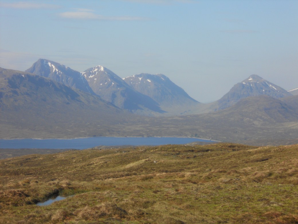
 When the upper slopes of Carn Breac are attained the view of the Achnashellech Hills opens up in a most remarkable manner. There, spread before you are Fuar Tholl, Sgorr Ruadh, Beinn Liath Mhor. The eye is then drawn northwards, towards the Torridonian Peaks. We could see both Liathach and Beinn Eighe, and the defile between them, from where we’d made our way down to the road the day before. It looked grim and forbidding over there, the skies being an ominous shade of grey. And for us the weather was coming in too, deteriorating on the final approach to the summit with the cloud base dropping to envelope us in whiteness.

